NASA examines a powerful thunderstorm complex over Oklahoma

When a powerful complex of thunderstorms affected Oklahoma NASA's Global Precipitation Measurement mission or GPM core satellite analyzed the power of those storms. More storms are expected on June 26.
An MCS or mesoscale convective system is a complex of thunderstorms that becomes organized on a scale bigger than individual thunderstorms but smaller than extratropical cyclones. This group of thunderstorms usually persists for several hours or more.
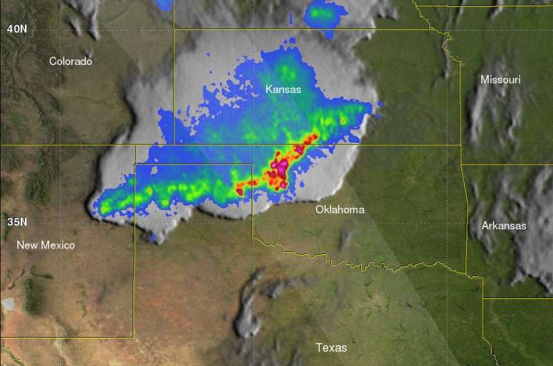
The GPM Core observatory satellite passed over Oklahoma on Monday, June 25, 2018 at 4:08 a.m. CDT (0508 UTC) when an MCS was affecting the state. The GPM satellite makes measurements of precipitation with its GPM Microwave Imager (GMI) and Dual-Frequency Precipitation Radar (DPR) instruments every 95 minutes. GPM is a joint mission between NASA and the Japan Aerospace Exploration Agency, JAXA.
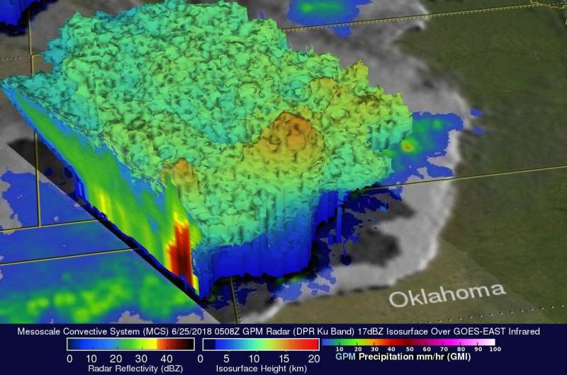
When GPM passed directly over the center of the MCS that was moving across Oklahoma, it found that the MCS contained some intense storms. GPM's DPR can make accurate rainfall measurements along its 151.9 mile (245km) swath and measure storms to heights of 11.8 miles (19km). GPM's DPR measured rain falling at a rate of greater than 7.4 inches (188 mm) per hour in a few of the powerful storms that were located over northwestern Oklahoma.

At NASA's Goddard Space Flight Center in Greenbelt, Maryland, the GPM core observatory satellite's radar data (DPR ku Band) were used to reveal the 3-D structure of precipitation within the storm system. GPM's radar showed a few storm tops in this MCS were reaching heights of over 9.5 miles (15.4km).
On June 26, the National Weather Service in Norman, Oklahoma noted that more storms are expected, "A complex of storms is expected to develop this afternoon across eastern Kansas into Missouri. This activity will then move south and may clip parts of north central Oklahoma this evening. Isolated strong to marginally severe storms will be possible with the strongest storms capable of quarter size hail and 60 mph wind gusts."
Provided by NASA's Goddard Space Flight Center


