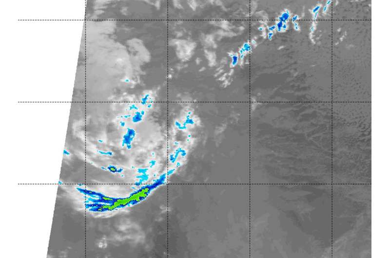
NASA data shows Otis devoid of precipitation, now a remnant

Former Hurricane Otis was not showing any thunderstorm development or precipitation on satellite imagery on Sept. 19. As a result, the National Hurricane Center declared Otis a remnant low pressure area.
NASA's Aqua satellite got a last look at the dying storm on Sept. 19 at 4:35 a.m. EDT (0935 UTC). That's when the Moderate Resolution Imaging Spectroradiometer or MODIS instrument aboard NASA's Aqua satellite analyzed Otis' cloud top temperatures in infrared light.
MODIS found cloud top temperatures had warmed significantly over the previous 12 hours and there was just one lone band of thunderstorms south of the center where temperatures were as cold as minus 50 degrees Fahrenheit. The clouds over the center of the circulation were much warmer and were not generating any precipitation.
The National Hurricane Center (NHC) noted at 11 a.m. EDT on Sept. 19 that "Otis has been devoid of deep convection for about 10 hours, and the cyclone only consists of a compact swirl of low-level clouds. Therefore, Otis is now classified as a remnant low, and this is last advisory issued by the National Hurricane Center."
At 8 a.m. PDT (11 a.m. EDT/1500 UTC), the center of Post-Tropical Cyclone Otis was located near 19.0 degrees north latitude and 128.6 degrees west longitude. That's about 1,235 miles (1,985 km) west of the southern tip of Baja California, Mexico.
The post-tropical cyclone is moving toward the west near 6 mph (9 kph). A west to west-southwest motion is expected during the next day or so. Maximum sustained winds are near 35 mph (55 kph) with higher gusts. Weakening is forecast. The estimated minimum central pressure is 1006 millibars.
The NHC said that continued weakening due to cool sea surface temperatures and dry air is expected, and Otis is expected to dissipate in a day or so.
Provided by NASA's Goddard Space Flight Center


