NASA observes Tropical Storm Dora dissipating rapidly

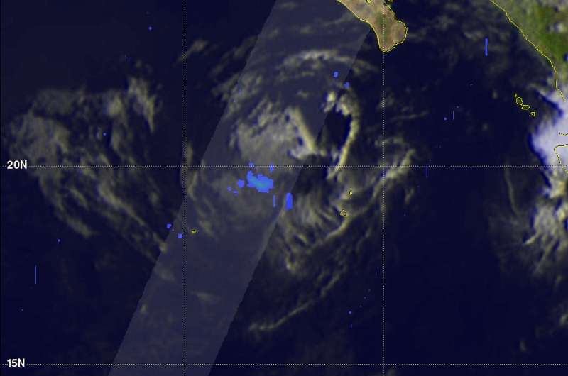
Two days of satellite imagery from the Global Precipitation Measurement mission or GPM core satellite showed that Dora, formerly a hurricane, went from generating moderate rainfall to barely any rainfall.
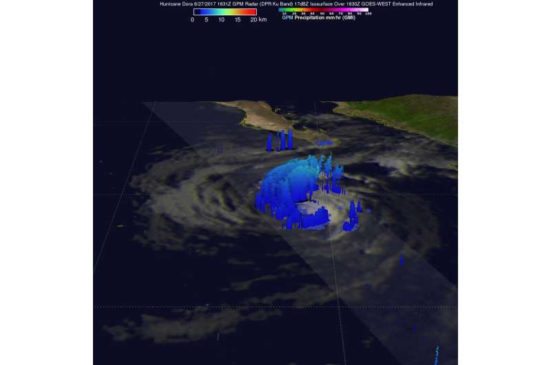
The GPM core observatory satellite again flew over Hurricane Dora on June 27, 2017 at 1631Z. Dora was moving over cooler ocean waters and was starting to rapidly dissipate.
On June 27, convection, rising air that forms thunderstorms that make up a tropical cyclone, was absent in most of Dora's southeastern side. Dora's low level center of circulation had become exposed to outside winds. On that day, GPM's Dual-Frequency Precipitation Radar (DPR) showed that rain was still coming down at a rate of up to 2.66 inches (67.8 mm) per hour in a small area of the storm. A day later, the system was barely generating rain.
At NASA's Goddard Space Flight Center in Greenbelt, Maryland, GPM's radar (DPR Ku Band) were used to uncloak the 3-D structure of precipitation within rapidly dissipating hurricane Dora on June 27. On that day, the DPR showed tallest storm tops within Dora were reaching altitudes of 5.9 miles (9.5 km).
Early Wednesday, June 28, GPM data revealed that the only thing left of Dora's circulation were low to mid-level clouds and very little rain.
By June 29 at 4:47 a.m. EDT (08:47 UTC), the National Hurricane Center or NHC said that the remnant low of Dora is centered near 21 degrees north latitude and 116 degrees west longitude, over the open waters of the Eastern Pacific Ocean. The remnant low pressure area had a central pressure of 1010 millibars.
NHC said that the low pressure area will dissipate by Friday, June 30.

Provided by NASA's Goddard Space Flight Center


