NASA provides two views of former Tropical Cyclone Vardah

NASA satellite data provided a look at the cloud cover and rainfall rates within Tropical Cyclone Vardah. The Global Precipitation Measurement mission or GPM core satellite measured rainfall rates as Vardah was headed for landfall. After landfall, NASA-NOAA's Suomi NPP satellite captured an image of the storm's cloud cover as it weakened to a remnant low pressure area over southern India.
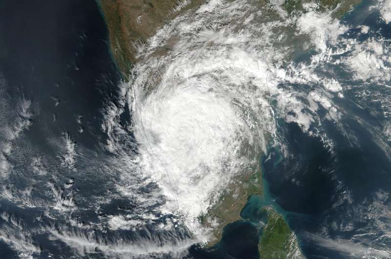
On Dec. 13 at 3:24 a.m. EST (0824 UTC) the Visible Infrared Imaging Radiometer Suite (VIIRS) instrument aboard NASA-NOAA's Suomi NPP satellite provided a visible-light image of the Vardah's remnants over southern India.
On Dec. 13, India's Regional Specialized Meteorological Centre (RSMC) noted that Vardah, locally known as "Bob" was located over the north interior of the state of Tamil Nadu. Vardah was moving westward and weakened into a remnant low pressure area. RSMC has issued a Heavy Rainfall Warning: "Rainfall at many places with isolated heavy falls over north interior Tamil Nadu and adjoining areas of south interior Karnataka & north Kerala is very likely [today]."
On the previous day, Vardah moved in from the Bay of Bengal pounding Chennai, India with winds of 75 knots (86 mph) and heavy rainfall. That means that Vardah was the equivalent of a category one hurricane on the Saffir-Simpson hurricane wind scale when it came ashore. Four tropical cyclones have formed in the Bay of Bengal this year with Vardah being the most powerful.

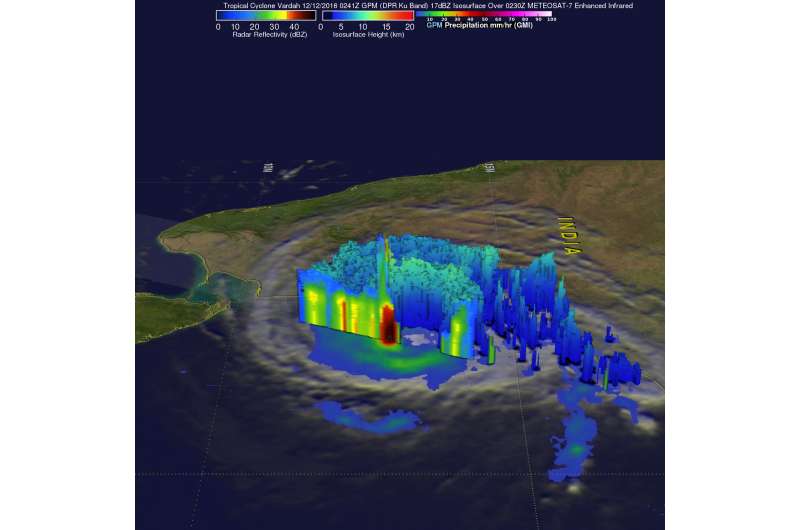
Vardah was approaching Chennai from the Bay of Bengal when the GPM core observatory satellite passed directly above the storm Dec. 11 at 9:41 p.m. EST (Dec. 12 at 0241 UTC) GPM's Microwave Imager (GMI) and Dual-Frequency Precipitation Radar (DPR) data collected at that time showed that very heavy rainfall was present in storms in the southern side of the eye. Rain was measured by GPM's DPR falling at a rate of over 235 mm (9.25 inches) per hour.
At NASA's Goddard Space Flight Center in Greenbelt, Maryland, GPM's Radar data were used to analyze the 3-D structure of precipitation within tropical Cyclone Vardah. The violent storms in the southern side of Vardah's eye were revealed by GPM's radar (DPR Ku Band) to reach altitudes of almost 16 km (9.9 miles). A 3-D cross section by GPM's DPR through the center of Vardah's eye showed that some downpours were returning radar reflectivity values greater than 82 dBZ to the satellite. GPM is a joint mission between NASA and the Japanese space agency JAXA.
RSMC issued the final bulletin on the system on Dec. 13.
Provided by NASA's Goddard Space Flight Center


