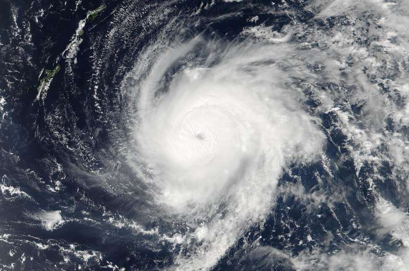
NASA sees Lionrock strengthen into a typhoon

NASA-NOAA's Suomi NPP satellite passed over Typhoon Lionrock as it strengthened to a typhoon east of Japan's Ryukyu Islands. The chain of islands stretch southwest from Kyushu to Taiwan.
On Aug. 24 at 12:45 a.m. EDT (0445 UTC) the Visible Infrared Imaging Radiometer Suite (VIIRS) instrument aboard the NASA-NOAA Suomi NPP satellite captured a visible light image of strengthening Typhoon Lionrock. The VIIRS image revealed that the typhoon had developed an eye, and it was surrounded by powerful thunderstorms.
VIIRS collects visible and infrared imagery and global observations of land, atmosphere, cryosphere and oceans.
At 11 a.m. EDT (1500 UTC) on Aug. 24 Lionrock had become a typhoon. Maximum sustained winds had increased to 75 mph (65 knots/120.4 kph). Lionrock was centered near 26.0 degrees north latitude and 133.3 degrees east longitude. That's about 297 nautical miles east of Kadena Air Base, Okinawa, Japan. Lionrock was moving to the southwest at ~7 mph (6 knots/11.1 kph).
Lionrock is moving southwest before it is expected to turn around onto a northeasterly course.
Provided by NASA's Goddard Space Flight Center


