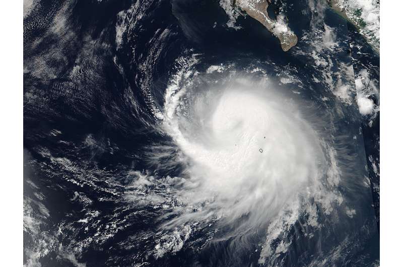
NASA scans Tropical Storm Frank's winds

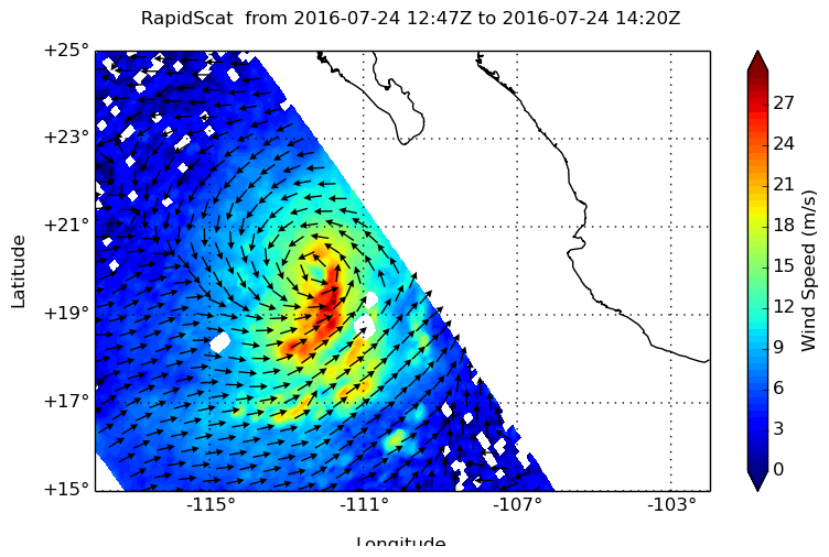
RapidScat is an instrument that flies aboard the International Space Station and measures winds over an ocean surface. RapidScat provided a look at the winds around Tropical Storm Frank in the Eastern Pacific and saw strongest winds south of the center.
On July 24, RapidScat showed that RapidScat measured wind speeds near 29 meters per second (65 mph/104.6 kph) south and east of the center. RapidScat showed that winds around the rest of the storm were about 18 meters per second (40 mph/64 kph).
On July 25, RapidScat data showed that tropical-storm-force winds extend outward up to 80 miles (130 km) from the center.
The RapidScat instrument measures Earth's ocean surface wind speed and direction over open waters. Surface wind speed is always lower than speeds at higher altitude. RapidScat is an important tool for meteorologists, because it shows forecasters the location of the strongest winds in different quadrants of an area of low pressure or tropical cyclone as they are not always equally distributed.
On July 25 at 11 a.m. EDT (1500 UTC) maximum sustained winds remain near 65 mph (100 kph) with higher gusts. The center of Tropical Storm Frank was located near latitude 20.4 North, longitude 113.9 West. Frank is moving toward the west near 6 mph (9 kph) and a west-northwestward motion at a faster forward speed is expected over the next 48 hours.

Frank is close enough the coast of western Mexico that the storm is generating ocean swells and rough surf. Swells associated with Frank are affecting the coasts of the southern Baja California peninsula and the state of Sinaloa. These swells could cause life-threatening surf and rip currents.
The National Hurricane Center said that little significant change in strength is forecast today, with weakening likely to begin by late Tuesday.
Provided by NASA's Goddard Space Flight Center


