NASA analyzes Hurricane Darby's winds, convection

NASA found the strongest winds in Hurricane Darby were occurring on its eastern side before northeasterly wind shear started affecting the storm.
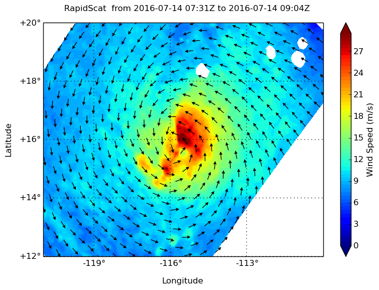
NASA's RapidScat instrument measured the surface winds around Hurricane Darby on July 14 between 0731 to 0904 UTC (3:31 to 5:04 a.m. EDT) and found the strongest winds east of the center of circulation near 30 meters per second (67 mph/108 kph). Hurricane-force winds were found to extend outward up to 25 miles (35 km) from the center, and tropical-storm-force winds extend outward up to 90 miles (150 km).
The RapidScat instrument that flies aboard the International Space Station measures Earth's ocean surface wind speed and direction over open waters. Surface wind speed is always lower than speeds at higher altitude
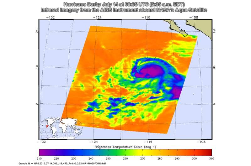
On July 14 at 09:35 UTC (5:35 a.m. EDT) infrared data from the Atmospheric Infrared Sounder or AIRS instrument aboard NASA's Aqua satellite showed that Darby's strong convection (rising air that condenses into clouds and thunderstorms that make up a tropical cyclone) and coldest cloud top temperatures were south and southwest of the center of circulation. Those cloud top temperatures were as cold as minus 63 Fahrenheit/minus 53 Celsius indicating they stretched high into the troposphere.

The National Hurricane Center said Darby still appears to be feeling the effects of 10 to 15 knots of northeasterly vertical wind shear. Recent microwave images continue to show a mid-level eye, but the deep convection has an asymmetric structure, primarily focused to the south and southwest of the center.
At 11 a.m. EDT (1500 UTC) on July 14 the center of Hurricane Darby was located near latitude 15.9 North latitude and 116.9 west longitude. That puts the center of Darby about 665 miles (1,070 km) southwest of the southern tip of Baja California, Mexico. Darby is moving toward the west near 13 mph (20 kph), and this general motion is expected to continue during the next few days. The estimated minimum central pressure is 989 millibars.
Maximum sustained winds remain near 80 mph (130 kph) with higher gusts. The National Hurricane Center said that some gradual strengthening is forecast during the next day or two.
Provided by NASA's Goddard Space Flight Center


