NASA sees wind shear affecting Tropical Cyclone 02A

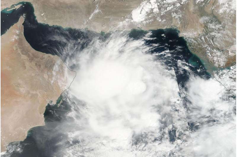
Tropical Cyclone 02A made its way west across the Arabian Sea and NASA's Aqua satellite passed over the storm when it was just off the coast of Oman. Infrared data showed the storm was beginning to elongate from wind shear.
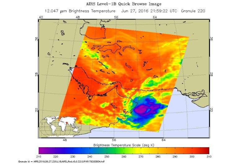
Infrared data taken from NASA's Aqua satellite on June 27, 2016 at 2159 UTC (5:59 p.m. EDT) showed cold cloud top temperatures in strong storms just off the coast of Oman. The Atmospheric Infrared Sounder or AIRS instrument flies aboard Aqua. AIRS data was made into a false-colored infrared image at NASA's Jet Propulsion Laboratory in Pasadena, California.
The AIRS data showed cold cloud top temperatures near minus 63 degrees Fahrenheit (minus 53 degrees Celsius) in storms pushed west of the center of circulation, indicating wind shear is affecting the storm from a tropical easterly jet stream. The imagery also showed that the storm had begun to elongate from the wind shear.
On June 28, 2016 the Joint Typhoon Warning Center noted that 02A is turning back to the east and it is not expected to make landfall in Oman.
At 1500 UTC (11 a.m. EDT) on June 28, 2016 Tropical Cyclone 02A was located about 253 nautical miles east of Masirah Island. Maximum sustained winds were near 35 knots (40 mph/62 kph). 02A has tracked south-southwestward at 4 knots
The Joint Typhoon Warning Center said that 02A will begin making a southeastward turn later in the day on June 28, 2016 "as it interacts with enhanced southwesterly monsoonal flow. The tropical cyclone is forecast to fully dissipate on June 29, 2016 due to unfavorable vertical wind shear conditions."

Provided by NASA's Goddard Space Flight Center


