Tropical Storm Ula weakens, moves south

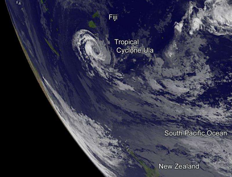
Former hurricane Ula has weakened to a tropical storm in the Southern Pacific Ocean. NOAA's GOES-West satellite captured an infrared image of the storm on Jan. 5 that showed it moved further south of Fiji.
NOAA's GOES-West satellite captured an infrared image of Tropical Storm Ula at 1500 UTC (10 a.m. EST) is it continued moving west in the South Pacific Ocean, while remaining a couple hundred miles south of Fiji. The infrared image showed stronger thunderstorms on the western side of circulation.
At 0900 UTC (4 a.m. EST) on Jan. 5, Ula's maximum sustained winds had dropped to 55 knots (63.2 mph/101.9 kph). Ula continues to track to the west at 3 knots (3.4 mph/5.5 kph) and into increasing vertical wind shear, which is expected to keep weakening the storm. Ula was centered near 21.8 degrees south latitude and 177.6 degrees east longitude, about 227 nautical miles (261.2 miles/420.4 km) south of Suva, Fiji.
Ula is tracking west under the influence of a low to mid-level subtropical ridge (elongated area) of high pressure to the south of the system.
The Joint Typhoon Warning Center forecast calls for Ula to continue moving in a westerly direction and gradually weaken and dissipate within a couple of days.
Provided by NASA's Goddard Space Flight Center


