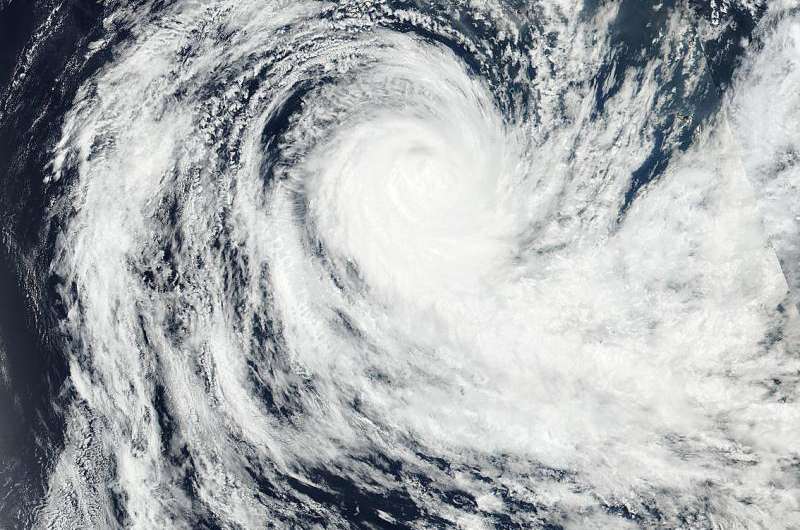
NASA-NOAA's Suomi NPP satellite sees Ula moving away from Fiji

Tropical Cyclone Ula affected the Fiji group of islands over the weekend of January 2 and 3. Early on January 4, NASA-NOAA's Suomi NPP satellite showed the storm moved south as all Fiji warnings were dropped.
The Visible Infrared Imaging Radiometer Suite (VIIRS) instrument aboard NASA-NOAA's Suomi NPP satellite captured an image of Tropical Cyclone Ula moving away from Fiji on January 4, 2016. All warnings and watches for Fiji have been dropped. The visible-light image showed that the eye was no longer visible. Bands of thunderstorms continued to circle the center of the storm.
VIIRS collects visible and infrared imagery and global observations of land, atmosphere, cryosphere and oceans.
At 0900 UTC (4 a.m. EST) on Jan. 4, the Joint Typhoon Warning Center (JWTC) noted that animated enhanced infrared satellite imagery showed thunderstorm development had diminished over the northern quadrant of the storm as moderate vertical wind shear between 20 and 25 knots (23 to 28.7 mph/37 kph to 46.3 kph) was affecting the storm.
Tropical cyclone Ula was centered near 22.3 degrees south latitude and 179.2 degrees east longitude, about 256 nautical miles (294 miles/474 km) south of Suva, Fiji. Ula's maximum sustained winds dropped to 70 knots (80.5 mph/129.6 kph), making it a category 1 hurricane on the Saffir-Simpson Wind Scale. Ula was moving to the southwest at 4 knots (4.6 mph/7.4 kph).
Although all tropical cyclone watches and warnings have been canceled for Fiji, a trough of low pressure remains slowing moving over Fiji generated a weather bulletin from the National Weather Forecasting Centre, Nadi, Fiji at 7:46 p.m. Fiji local time (1:46 a.m. EST) on January 4, 2016. The bulletin noted that a strong wind warning remains in force for land areas of Lau Group, Yasawa and Mamanuca Group, Northern and Southern Viti Levu, the Lomaiviti group, Kadavu, Vanua Levu, Taveuni and the nearby smaller islands. For updated forecasts, visit the Fiji Meteorological Service website: http://www.met.gov.fj/
Ula is expected to turn west and continue to gradually weaken as it runs into cooler waters, drier air, and increasing vertical wind shear. Ula is expected to dissipate within three days.
Provided by NASA's Goddard Space Flight Center


