NASA sees tropical storm 27W form in Marianas Islands, warnings up

The tropical low pressure area previously known as System 95W consolidated and was classified as a Tropical Depression 27W on Nov. 17, 2015. The Suomi NPP satellite captured a view of the strengthening storm as warnings were posted in Micronesia.
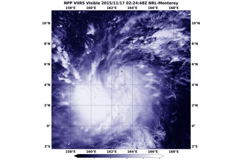
Tropical Storm 27W was captured in a visible-light image from the VIIRS instrument aboard NASA-NOAA's Suomi NPP satellite on Nov. 17 at 0224 UTC (Nov. 16 at 9:24 p.m. EST). The VIIRS image showed the low-level center of circulation continued to consolidate. Wide bands of thunderstorms in the southern quadrant of the storm were wrapping into the eastern side of the storm.
At 1200 UTC (7 a.m. EST) on Nov. 17, a tropical storm warning was in effect for Sapwuafik, Micronesia. Tropical storm force winds of 39 to 73 mph are expected within 24 hours. A tropical storm watch remains in effect for Pohnpei, Nukuoro and Pakin in Pohnpei State. These islands are part of the Federated States of Micronesia. A tropical storm watch is also in effect for Lukunor, Losap, Chuuk and Fananu in Chuuk state. A tropical storm warning means that tropical storm force winds of 39 to 73 mph are possible within 24 to 48 hours.
At 1200 UTC (7 a.m. EST) on Nov. 17 (10 p.m. CHST (Guam) local time on Nov. 16) the center of tropical storm 27W was located by satellite near latitude 4.7 degrees north and longitude 159.8 degrees east. That's about 190 miles southeast of Pohnpei and Pakin and about 185 miles east-southeast of Sapwuafik.
27W was moving west-northwest at 18 mph. Tropical storm 27W is expected to continue on this track over the next 24 to 48 hours. Maximum sustained winds have increased to 40 mph. Tropical storm force winds extend outward up to 30 miles from the center.
The Joint Typhoon Warning Center forecast takes the tropical cyclone on a west-northwestward path passing Pohnpei, Fananu and Chuuk before intensifying to typhoon-force. The forecast calls for Tropical Cyclone 27W to be at typhoon-force as it is expected to pass just south of Guam on Nov. 21.
Provided by NASA's Goddard Space Flight Center


