NASA sees Typhoon Choi-wan moving north in Western Pacific

Typhoon Choi-wan continued to move north in the western Pacific Ocean as NASA's Aqua satellite passed overhead in space on October 6 and took an infrared look at the storm. Earlier, the RapidScat instrument aboard the International Space Station measured the storm's strongest winds.
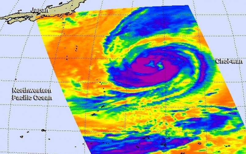
NASA's Aqua satellite passed over Typhoon Choi-wan on Oct. 6 at 0317 UTC (Oct. 5 at 11:17 p.m. EDT) and the Atmospheric Infrared Sounder (AIRS) instrument measured cloud top temperatures. The higher the cloud top, the more uplift (of air) in a storm, and the stronger it tends to be. AIRS saw powerful thunderstorms with cloud top temperatures near -63F/-53C circling the open eye. The imagery shows that this large system is becoming slightly elongated despite retaining a well-defined low-level center.
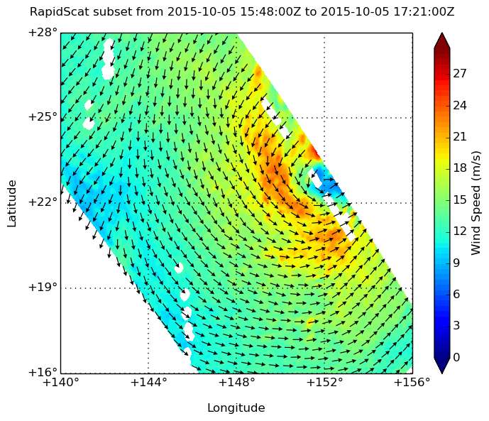
On October 5 at 1 p.m. EDT, RapidScat looked at the western half of Typhoon Choi-wan and saw the entire western side had sustained winds near 27 meters per second (60.4 mph/97.2 kph). RapidScat measures wind speed at the surface which is always lower than speeds at higher altitude.
The Joint Typhoon Warning Center (JTWC) noted that Choi-wan's maximum sustained winds were near 70 knots (80.5 mph/129.6 kph) at 1500 UTC (11 a.m. EDT) on October 6. It was centered near 25.9 North latitude and 150.7 East longitude, about 512 nautical miles (589 miles/948 km) east of Iwo To island, Japan. It was moving north at 8 knots (9.2 mph/14.8 kph).
The JTWC forecast calls for Choi-wan to continue weakening as it progresses on a northerly track, reaching the southern Kuril Islands by October 8 as an extra-tropical storm.

Provided by NASA's Goddard Space Flight Center


