NASA sees Tropical Storm Mujigae moving through South China Sea

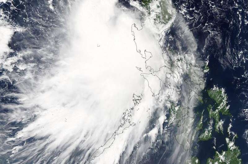
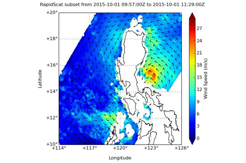
Tropical Storm Mujigae tracked over the northern Philippines and as it entered the South China Sea, NASA's Aqua satellite captured an image of the storm. NASA's RapidScat instrument aboard the International Space Station analyzed the storm's surface winds.
On October 1, the International Space Station made a pass over Tropical Storm Mujigae just before it made landfall in the Philippines and the RapidScat instrument measured the storm's surface winds. RapidScat saw maximum sustained winds in the northern quadrant of the storm near 24 meters per second (53.6 mph/86.4 kph).
On October 2, the Joint Typhoon Warning Center noted that animated enhanced infrared satellite imagery showed the system had further consolidated as stronger bands of thunderstorms were wrapping into the large circulation center. In addition, microwave data revealed a "semi-closed eye."
The Moderate Resolution Imaging Spectroradiometer or MODIS instrument aboard NASA's Aqua satellite captured a visible image of Tropical Storm Mujigae exiting the Philippines on Oct. 2 at 05:25 UTC (1:25 a.m. EDT) and moving through the South China Sea. No eye was visible in the image and the storm was almost completely over water, except for the eastern quadrant, which still blanketed part of Luzon. Infrared data, such as that from the Atmospheric Infrared Sounder or AIRS instrument that also flies aboard Aqua, showed that sea surface temperatures in the South China Sea were near 28 to 29 degrees Celsius (82.4 to 84.2 Fahrenheit), which will help re-strengthen the tropical storm as it moves west.

At 1500 UTC (11 a.m. EDT) on Oct. 2, Mujigae had maximum sustained winds near 45 knots (51.7 mph/83.3 kph). It was centered near 17.1 North latitude and 117.8 East longitude, about 238 nautical miles northwest of Manila, Philippines. Mujigae was moving to the west-northwest at 14 knots (16.1 mph/25.9 kph).
The Joint Typhoon Warning Center expects Mujigae to strengthen to 60 knots (69 mph/111 kph) by October 4, before it makes landfall in southeastern China, just north of Hainan Island.
Provided by NASA's Goddard Space Flight Center


