NASA sees remnants of Typhoon Choi-wan over southeastern Russia

An infrared NASA satellite image revealed that the remnants of Ex-Typhoon Choi-wan continued to generate rainy and windy weather over southeastern Russia on October 8.
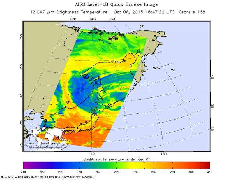
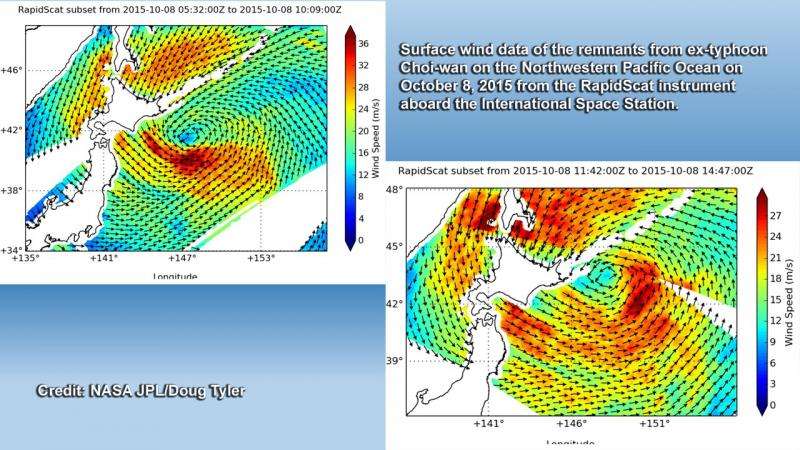
NASA's Aqua satellite passed over the remnants at 16:47 UTC (12:47 p.m. EDT) and gathered infrared data on the storm. Earlier, the RapidScat instrument aboard the International Space Station measured the storm's strongest winds.
The Atmospheric Infrared Sounder (AIRS) instrument aboard Aqua measured cloud top temperatures of the remnant storms. The higher the cloud top, the more uplift (of air) in a storm, and the stronger it tends to be. AIRS saw cloud top temperatures near -36F/-38.1C in clouds over southeastern Russia, stretching to the northeast over the Sea of Okhotsk, including over Russia's Sakhalin Island. The image showed a large system with its center in the southeastern Sea of Okhotsk, just east of the southernmost Kuril Islands.
In two passes on Oct. 8, the RapidScat instrument that flies aboard the International Space Station measured surface winds in the remnants of ex-typhoon Choi-wan. Early in the day strongest winds were south of the center near 35 meters per second/78 mph/126 kph. Late in the day strongest winds near 27 mps/60.4 mph/97.2 kph circled the storm. RapidScat measures wind speed at the surface which is always lower than speeds at higher altitude.
Choi-wan's remnants are expected to continue weakening in the Sea of Okhotsk. Showers remain in the forecast for Sakhalin Island through October 13, according to the Hydrometeorological Centre of Russia. For updated forecasts, visit: http://wmc.meteoinfo.ru/forecasts5000/russia/sakhalin-area.

Provided by NASA's Goddard Space Flight Center


