NASA's GPM reveals very strong thunderstorms in Typhoon Choi-Wan

NASA's GPM satellite saw strong thunderstorms remained in Typhoon Choi-wan as the storm continued to weaken. On October 7, the typhoon had weakened to a tropical storm.
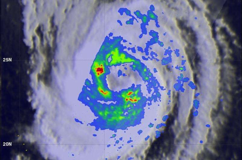
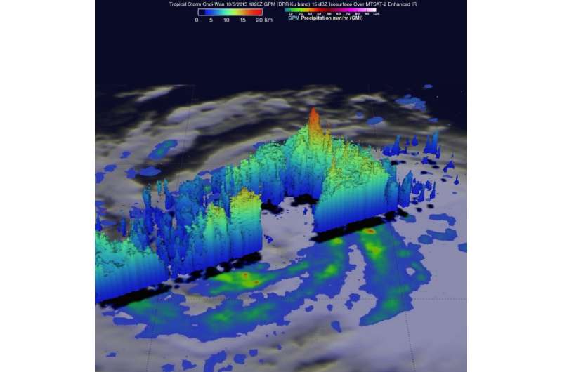
The Global Precipitation Measurement or GPM core observatory satellite flew above tropical storm Choi-Wan on October 5, 2015 at 1828 UTC (2:28 p.m. EDT) and then saw Choi-Wan again as a hurricane on October 6, 2015 at 0448 UTC (12:48 a.m. EDT).
With the first orbit on October 5, 2015 GPM's 3-D radar (DPR Ku Band) found that powerful thunderstorms moving into Choi-Wan's southeastern side had storm tops reaching unusually high altitudes of up to 18.5 km (11.5 miles).
The tropical cyclone was spreading clouds and rain over a large area of the northwest Pacific Ocean southeast of Japan. GPM discovered that Choi-wan's organization had slightly improved. GPM's Microwave Imager (GMI) and Dual-Frequency Precipitation Radar (DPR) instruments were able to peer through the overcast and reveal the locations of rainfall bands within the tropical cyclone. GMI found several areas where Choi-Wan was dropping rain at a rate of over 66 mm (2.6 inches) per hour.
On October 7 at 1500 UTC (11 a.m. EDT), Choi-wan had maximum sustained winds near 60 knots (69 mph/111 kph). It was centered near 35.0 North latitude and 150.8 East longitude, about 576 nautical miles (662 miles/ 1,067 km) east of Yokosuka Japan. Choi-wan was racing northward at 24 knots (27.6 mph/44.4 kph).

Choi-wan is moving north and is weakening. The storm is expected to become extra-tropical northeast of Japan upon approach to the Kuril Islands.
Provided by NASA's Goddard Space Flight Center


