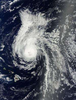
Julio embarking on weakening trend

The Central Pacific Hurricane Center has issued its 30th warning on Julio today at 1500 GMT. Julio's position at this point is 395 miles northeast of Honolulu, Hawaii moving northwest at 8 knots per hour. Julio is moving toward the northwest near 9 mph, 15 km/h. Maximum sustained winds are near 75 mph, 120 km/h, with higher gusts. Julio is expected to weaken slightly over the next 48 hours, down to tropical storm strength by tonight.
At present, hurricane force winds extend outward up to 25 miles, 35 km, from the center, and tropical storm force winds extend outward up to 155 miles, 250 km.
Julio is moving northwest and has embarked on a weakening trend. The storm is anticipated to pass to the north of the Hawaiian islands. Julio is expected to continue moving northwest through Wednesday, then gradually turn north into the open Pacific. Large swell will produce dangerous surf conditions on east coasts of most Hawaiian islands.
Provided by NASA's Goddard Space Flight Center


