NASA sees Tropical Storm Neoguri losing punch along southern Japan's coast

Once a powerful super typhoon, now an weakening tropical storm, NASA's Terra satellite saw a much weaker Tropical Storm Neoguri moving along the southern coast of Japan.
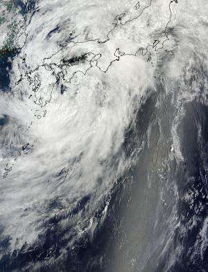
On July 10 at 0:35 UTC, the Moderate Resolution Imaging Spectroradometer (MODIS) instrument aboard NASA's Terra satellite captured an image of a more disorganized Tropical Storm Neoguri over east central Japan. At the time of the image, a more elongated Tropical Storm Neoguri's center was east of Kyushu, Japan.
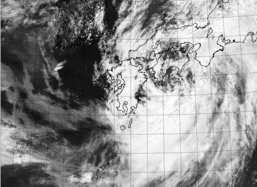
A visible image from the Visible Infrared Imaging Radiometer Suite (VIIRS) instrument aboard NASA-NOAA's Suomi NPP satellite taken July 10 at 03:59 UTC showed a more elongated Tropical Storm Neoguri off Japan's southern coast. VIIRS collects visible and infrared imagery and global observations of land, atmosphere, cryosphere and oceans.
On July 10 at 09:00 UTC (5 a.m. EDT), the Joint Typhoon Warning Center (JTWC) noted that Tropical Storm Neoguri's maximum sustained winds had dropped to 45 knots (51.7 mph/83.3 kph). Neoguri was centered near 33.8 north latitude and 135.8 east longitude, or about 127 nautical miles (146.1 miles/235.2 km) southeast of Iwakuni, Japan. Neoguri has tracked east-northeastward at 29 knots (33.3 mph/53.7 kph). Earlier in the week, when Neoguri was a super-typhoon, it was generating seas over 45 feet high (13.7 meters). Now, as a tropical storm, Neoguri is kicking up maximum wave heights near 8 feet (2.4 meters).

Radar from the Japanese Meteorological agency showed that Neoguri had an exposed low-level circulation center and the development of thunderstorms was waning. Moderate to strong southwesterly wind shear of 20 to 30 knots (23.0 to 34.5 mph/37.0 to 55.5 kph) was pushing Neoguri's thunderstorms northeast of the center of circulation.
Provided by NASA's Goddard Space Flight Center


