Six years and 12,000 holes: Cyprus mapped

It was a marathon project that took six years and the collection and analysis of some 12,000 soil samples, but an international team of geologists has managed to create the Geochemical Atlas of Cyprus.
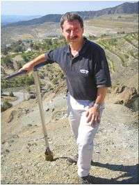
"This is the most detailed geochemical map ever undertaken at a national scale," says Associate Professor David Cohen, who led the project in collaboration with the Cyprus Geological Survey.
The $1.25 million project forms part of a more general geochemical mapping of Europe that was prompted, in part, by the need to assess the impact of the 1986 Chernobyl nuclear disaster on the soils of countries in the region.
Professor Cohen, who heads the UNSW School of Biological, Earth and Environmental Sciences, has just returned from an international symposium held in Nicosia to mark the atlas’s completion.
The symposium included a visit to Skouriotissa, the only operating copper mine in a country with about 4,000 years of mining history.
"The geological core of Cyprus contains a complex slice of oceanic crust - an ophiolite - that was thrust up in the late Miocene as Africa rammed into Europe," notes Professor Cohen.
"The human history of Cyprus is also complex, with the island first settled in the Neolithic period and subsequently exploited for its copper and timber resources over the last 3,000 years or so.
“The Atlas will have a wide range of applications in mineral exploration, environmental assessments and landuse planning.
“Although initial analysis of the data indicates substantial meta-contamination of soils in urban areas and around the many abandoned copper mines, the main control on the geochemistry of the soils is the underlying geology.”
The most prominent physical feature of Cyprus is the Troodos Mountains, which have been logged and mined for copper sporadically since the Phoenecians sailed the Mediteranean Sea. There is debate as to whether the island gave its name to the metal or the reverse. Some areas of surface metal contamination can be traced to Roman mine workings.
The final soil sample was collected in 2009 by the President of Cyprus, Dimitris Christofias, in the Presidential Palace Gardens.
Metal contamination of the environment is of general concern, especially in industrialised areas, notes Professor Cohen.
The study forms part of an international program of geochemical mapping which will eventually generate a global baseline against which both local and global anthropogenic contributions of metals can be measured.
Such measurements can be repeated at suitable time intervals to assist long-term monitoring of global environmental change.
Provided by University of New South Wales


