Mysteries of Rain and Snow

People have lived with rain and snow for millennia, and scientists have studied weather for more than a century. You might think that, after all that time, we would have precipitation pretty much figured out. And you'd be wrong.
"It's amazing how much we don't know about global patterns of rain and snow," says Walt Petersen, an atmospheric scientist with the National Space Science and Technology Center (NSSTC) and the University of Alabama (UAH) in Huntsville.
For instance, how much snow falls worldwide each day--and where? How much water falls to Earth in the form of light, drizzly rain?
"These are just a few of the outstanding questions," he says. Answering them would fill significant gaps in our understanding of the Earth's climate system. What to do? "The best way to study global precipitation is from space."

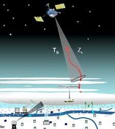
That's why NASA recently funded a suite of 59 research proposals under the agency's ongoing Precipitation Measurement Mission. The studies will look at ways to improve measurements of rain and snow from Earth orbit. Petersen is among the winners, and one of the things he'll be studying is snow:
"Snow is a huge problem," says Petersen. It turns out that estimating snowfall is very hard to do with radar. Rain is easier because it always consists of simple liquid-filled droplets. Radar echoes from rain clouds can be converted into rates of rainfall with fairly good precision. A radar onboard NASA's Tropical Rainfall Measurement Mission (TRMM) satellite, for instance, measures monthly rainfall within an accuracy of about 10%.
But frozen precipitation such as snow is much more variable. Famously, no two snowflakes are alike. The differing sizes, shapes, and densities of individual flakes mean they won't all fall at the same speed, complicating efforts to estimate rates of snowfall. Also, snowflakes have lots of crazy angles and planar "surfaces," which can make tricky radar echoes.
The problems don't end there. "Ice and snow have variable dielectric behavior depending on how much ice and how much air is contained in the particle," he adds. (Note: The dielectric constant of a substance tells how strongly the substance will interact with a radar wave.) "With raindrops, you are dealing primarily with water, which has a known and fixed dielectric constant. With snow, we know the dielectric constant for pure ice and we know the dielectric constant for air, but, the amounts of air and ice can vary quite a bit from snowflake to snowflake. Further, snowflakes also rime and melt. This means you can also have water on the surface--another complication!"
For these reasons, "our estimates of global snowfall are very uncertain," Petersen says. This applies to both ground- and space-based radars. Only in areas where snow depth is routinely measured via "stick-in-the-ground" methods do scientists have good estimates for the amount of water that falls as snow. The problem is, "there are relatively few of these measurement sites compared to the large area that needs to be measured."
Snow plays a big role in climate. When water evaporates, it carries away a lot of heat (which is why sweat cools down your skin as it evaporates). Later, when that moisture condenses inside clouds to form snowflakes, it releases this stored heat, warming the air. As more snow crystallizes, more heat is released, which in turn makes wind. When the snow falls, it takes water out of the atmosphere, leaving it drier. Snow on the ground also reflects sunlight back into space, which helps cool the planet. So learning to portray global snowfall correctly in computer climate simulations is critical for accurately predicting how the real climate will behave in the future.
Many of the newly funded studies will develop ways to estimate snowfall rates from radar data.
This is timely because in 2013 NASA plans to launch a new radar onboard the Global Precipitation Mission satellite (GPM). GPM will extend TRMM's observations by looking at precipitation beyond the tropics for the first time, orbiting at an angle that will bring it almost to the Arctic Circle (65 degrees latitude). At these higher latitudes, GPM will encounter lots of snow.
Along with snow, GPM will be able to detect lighter rainfall than TRMM can. If less than about 1 millimeter of rain falls per hour, it is invisible to TRMM. That's rarely an issue in the tropics, but at higher latitudes, light, drizzly rain is common. Although it's light, this rain can last for days, moving large amounts of water and releasing lots of heat into the atmosphere.
In industrialized nations with extensive rain-gauge networks, this light rainfall is well documented. But in much of the world, light rain goes unrecorded, leaving a large gap in our knowledge of global water cycles. GPM will be able to sense rain down to about 2/10 mm per hour.
Heavy rain, drizzle, snow—"it's all water," says Petersen. "We've got to keep track of it in every form to truly understand the climate of Earth."
Source: Science@NASA, by Patrick Barry, Dr. Tony Phillips


