UTSA geoscientists prepare for October trip to the Arctic

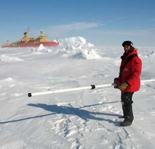
In October, UTSA College of Sciences faculty members Stephen Ackley and Blake Weissling wlll travel to the Arctic as a part of a project funded by the Office of Naval Research (ONR) to study the diminishing ice cover. The pair will join a team of nearly 20 scientists from around the world for the 42-day trip from Nome, Alaska into the Arctic Ocean.
Ackley has conducted research in the polar regions for more than 30 years and has a specific geographic location, "Ackley Point," named after him. Ackley Point is located on Ross Island, an island formed by four volcanoes in the Ross Sea, near Antarctica. This will be his 12th trip to study polar sea ice, conducted from either drifting ice camps or aboard a vessel.
An assistant research professor in the UTSA Department of Geological Sciences, Weissling has led UTSA students conducting ice research in the Arctic, the Antarctic and at Pico de Orizaba, a volcano east of Mexico City. Ackley and Weissling will travel on the "Sikuliak," an icebreaking ship making its maiden voyage into the ice.
Project leaders hope to develop methods to quantify how the ice is changing. Satellite remote sensing has captured how the ice surface area has been changing, but accurately measuring the region's ice thickness from above has been a challenge.
"The Navy is particularly concerned with improving its models for atmospheric sensing and for waves," said Ackley. "When the ice cover is taken away, then the potential for ocean waves builds up. The waves can be a major factor in any kind of economic development involving oil rigs, shipping, search and rescue efforts, and Navy operations. Large waves can also affect the native residents going out to hunt."
Weissling added, "We are going to be looking for storm events so we can measure the oceanographic, meteorological, and ice parameters associated with waves. We will be looking at how the waves are interacting with the ice edge, because the ice edge dampens wave fields dramatically."

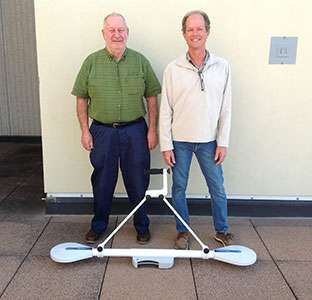
The UTSA researchers are supported by an ONR research grant as well as a $500,000 Department of Defense instrumentation grant. They have used the instrumentation grant to purchase sophisticated equipment including radars, a light detection and ranging (LIDAR) system and two electromagnetic induction meters. LIDAR systems incorporate a remote sensing method that uses light in the form of a pulsed laser to measure variable distances to the Earth. The electromagnetic induction instruments will enable researchers to measure sea ice thickness within a few centimeters of accuracy, either on the surface or from the vessel.
Once the researchers return, they envision another two years of data analysis.
After the exploratory trip is complete, UTSA faculty members representing various colleges will benefit. Much of the equipment purchased has additional applications and can be used in the geosciences, civil engineering, architecture and archaeology.
Provided by University of Texas at San Antonio


