NASA sees birth of Atlantic's subtropical depression seven: Bermuda on watch

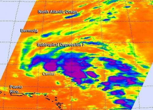
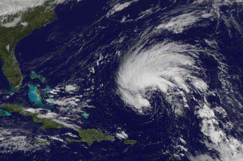
The seventh depression of the Atlantic Ocean Hurricane Season was born on Oct. 10, but it's subtropical. NASA's Aqua satellite looked at the developing depression in infrared light and saw strong thunderstorms within.
The Atmospheric Infrared Sounder or AIRS instrument aboard NASA's Aqua satellite captured data on developing Subtropical Depression 7 on Oct. 10 at 05:41 UTC (1:41 a.m. EDT). AIRS identified several areas of strong thunderstorms around the developing center of circulation. Some of those thunderstorms were high in the troposphere with cloud top temperatures near -63F/-53C and had the potential for dropping heavy rainfall. The circulation continued to organize after Aqua passed by and a depression formed.
A Tropical Storm Watch was posted at 11 a.m. EDT on Oct. 10 for Bermuda. The National Hurricane Center noted that tropical storm conditions are possible on Bermuda late Saturday, Oct. 11 or on Sunday, Oct. 12.
A subtropical cyclone, which is what this depression is, is different from a tropical depression. Here's how the National Hurricane Center distinguishes subtropical from tropical: A subtropical cyclone, like Subtropical Depression 7, "is a non-frontal low-pressure system that has characteristics of both tropical and extra-tropical cyclones. Like tropical cyclones, they are non-frontal, synoptic or large-scale cyclones that originate over tropical or subtropical waters, and have a closed surface wind circulation about a well-defined center. In addition, they have organized moderate to deep convection (development of clouds and thunderstorms from rising air), but lack a central dense overcast. Unlike tropical cyclones, subtropical cyclones derive a significant proportion of their energy from baroclinic sources, and are generally cold-core in the upper troposphere, often being associated with an upper-level elongated low pressure area or trough. In comparison to tropical cyclones, these systems generally have a radius of maximum winds occurring relatively far from the center (usually greater than 60 nautical miles), and generally have a less rounded (symmetric) wind field and distribution of convection."

At 11 a.m. EDT the center of subtropical depression Seven was located near latitude 23.8 north and longitude 63.7 west. That puts the center of Subtropical Depression 7 about 590 miles (950 km) south of Bermuda. Maximum sustained winds are near 35 mph (55 kph) with higher gusts. Some strengthening is forecast and the depression is forecast to become a subtropical storm later today.
Subtropical Depression 7's estimated minimum central pressure is 1005 millibars. The depression is moving toward the northwest near 10 mph (17 kph). A gradual turn toward the north, followed by a turn toward the northeast on Sunday.
Provided by NASA's Goddard Space Flight Center


