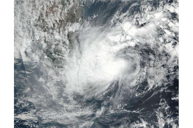
NASA sees Tropical Storm Nada affected by wind shear

NASA-NOAA's Suomi NPP satellite revealed that wind shear was affecting Tropical Cyclone Nada in the Northern Indian Ocean.
Tropical Cyclone 04B has been renamed Tropical Cyclone Nada. On Nov. 29 at 2:24 a.m. EST (07:24 UTC) the Visible Infrared Imaging Radiometer Suite (VIIRS) instrument aboard the NASA-NOAA Suomi NPP satellite captured a visible image of Tropical Cyclone Nada east of Sri Lanka. The VIIRS image shows that clouds associated with Nada were being pushed west of the center by easterly vertical wind shear.
As a result of the wind shear, the Joint Typhoon Warning Center or JTWC does not expect Nada to intensify before making landfall.
At 10 a.m. EST (1500 UTC) on Nov. 30, Tropical Cyclone Nada had maximum sustained winds near 52 mph (45 knots/83 kph). Nada was located near 9.9 degrees north latitude and 83.9 degrees north longitude, about 805 nautical miles south-southwest of Kolkata, India. Nada was moving to the west-northwest at 13.8 mph (12 knots/22 kph).
The JTWC forecast expects Nada to move west-northwest towards southern India, where it is expected to make landfall late on Oct. 1 (UTC). Nada is expected to cross southern India and could regenerate in the Arabian Sea.
Provided by NASA's Goddard Space Flight Center


