NASA sees Hurricane Lester approaching Hawaiian Islands

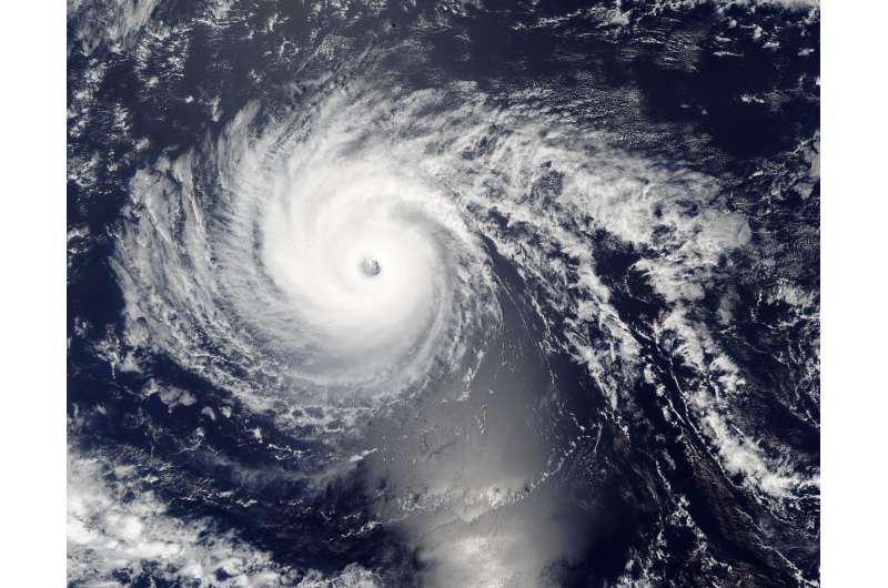
Hurricane Lester was nearing the Hawaiian Islands when NASA's Aqua satellite caught an image of the powerful and well-developed storm.
Hurricane Lester appeared well-developed and had a clear eye in imagery from the MODIS instrument or Moderate Resolution Imaging Spectroradiometer aboard NASA's Aqua satellite. Aqua passed over Lester on Sept. 1 at 6:50 p.m. EDT (22:50 UTC).
Forecaster Birchard from NOAA's Central Pacific Hurricane Center (CPHC) said, "Lester remains a strong and well-organized hurricane, with a solid ring of cold cloud tops surrounding the eye. However, the eye has been shrinking, and eye temperatures have cooled somewhat since the previous advisory, while the outflow has diminished in the southern semicircle. These observations indicate that Lester has weakened somewhat overnight."
The colder the cloud tops, the higher they are in the troposphere and stronger the storms.
On Sept. 2, a hurricane watch is in effect for Maui County, including the islands of Maui, Molokai, Lanai and Kahoolawe and Oahu. NOAA's CPHC said that interests elsewhere in the Hawaiian Islands should also monitor the progress of Lester.
At 11 a.m. EDT (5 a.m. HST/1500 UTC) the center of Hurricane Lester was located near 19.7 degrees north latitude and 148.4 degrees west longitude. That puts the eye of Lester about 435 miles (700 km) east of Hilo, Hawaii and 625 miles (1,005 km) east of Honolulu, Hawaii. The estimated minimum central pressure is 968 millibars.
Lester is moving toward the west-northwest near 14 mph (22 kph) and this motion is expected to continue for the next couple of days. Maximum sustained winds are near 110 mph (175 kph) with higher gusts. Lester is a strong Category 2 hurricane on the Saffir-Simpson Wind Scale. Gradual weakening is forecast over the next couple of days.
NOAA's CHPC said, "Hurricane conditions are possible over Maui County late tonight and Saturday, Sept. 3, and are possible over Oahu Saturday and Saturday night. In addition, large ocean swells generated by Lester will arrive in Hawaiian waters the next couple of days, including the northwestern Hawaiian Islands. Surf generated by these swells will peak this weekend in the main Hawaiian Islands, becoming very large and possibly damaging along exposed shorelines. Heavy rains associated with Lester may impact Maui county and Oahu from late tonight into Sunday. Sept. 4."
One note from CPHC is that the official forecast keeps the center of Lester northeast of the islands, a westward deviation from the official forecast track could bring profound impacts to Hawaii. Residents should closely monitor the progress of the storm at: http://www.prh.noaa.gov/cphc.
Provided by NASA's Goddard Space Flight Center


