Monitoring the 2015-2016 El Nino from the land, sea, and air
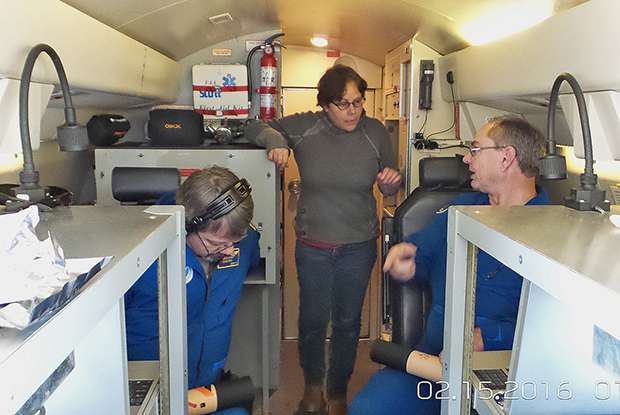
The ongoing El Niño of 2015-2016 is a historically strong event, the likes of which is only seen once or twice during a scientific career. Not wanting to let this opportunity pass by, scientists from NOAA and NASA have embarked on an unprecedented and exciting mission to observe this El Niño like no other El Niño has been observed before! From January to March 2016, scientists have been collecting data in a notoriously data-sparse region of the Pacific via Gulfstream jets, high-tech unmanned aircraft, ship cruises, weather balloon launches, and instruments dropped right out of aircraft. This effort is known as the El Niño Rapid Response campaign.
The deluge that wasn't
Why study this El Niño? As discussed in detail in previous blog entries, one significant way El Niño impacts the global climate is through changes in atmospheric wave forcing and large-scale circulations like the Walker Circulation and Hadley Circulation, which then shift the pathways taken by storms around the world. During the 1997-1998 El Niño, the North Pacific stormtrack was shifted southeastward, directing moisture-carrying storms toward California. This caused 13.68 inches of rain to fall in downtown Los Angeles in 1998—the wettest February since records began 130 years before.
There was, therefore, significant concern about the impact of the next big El Niño on California precipitation. By standard measures, the 2015-2016 El Niño has been tied with 1997-98 as the warmest El Niño in the instrumental record. However, only 0.79 inches of rainfall fell during February 2016 in downtown Los Angeles. To date, March 2016 rainfall totals are also significantly below average.
Ok, so the impacts of no two El Niños are the same. But why?
The first link that connects the tropical Pacific to California precipitation is the development of strong thunderstorms over the warmest waters. Thunderstorms are a primary agent for exchanging heat from the Earth's surface to the atmosphere above. The second link is the response of the atmospheric circulation to the organized thunderstorm activity. This involves the response of the large-scale overturning circulation (e.g. the Hadley Cell), which determines the location of the dry, sinking air masses in the subtropics and the edge of the subtropical stormtrack.
The exact location of that edge, which is occupied by the storm-steering subtropical jet stream, has a big influence on what part of the West Coast gets soaked in any given winter. To forecast this variability, weather and climate models need to be able to simulate not only the individual thunderstorm clusters in the tropics, but also how those thunderstorms affect the entire atmosphere around them.
But for models, problems exist from the get-go. The data available on the current state of the atmosphere to start or "initialize" the model is simply not good enough, especially in the Pacific Ocean. After all, in the tropical Pacific, there are not a lot of observations. And satellites can help only so much.
All hands on deck!

How can scientists improve the atmospheric models? After a suppressed Atlantic Hurricane season heavily influenced by El Niño, scientists at NOAA's Earth System Research Laboratory Physical Sciences Division used resources that NOAA had allocated for hurricane observations to instead launch the El Niño Rapid Response campaign to monitor El Niño and its impacts on California precipitation.
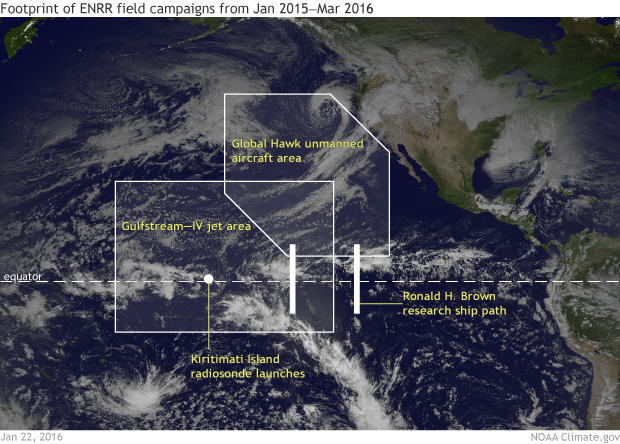
The El Niño Rapid Response campaign coordinated observations collected from aircraft (both piloted and unmanned), a ship, and from remote islands in the Pacific:
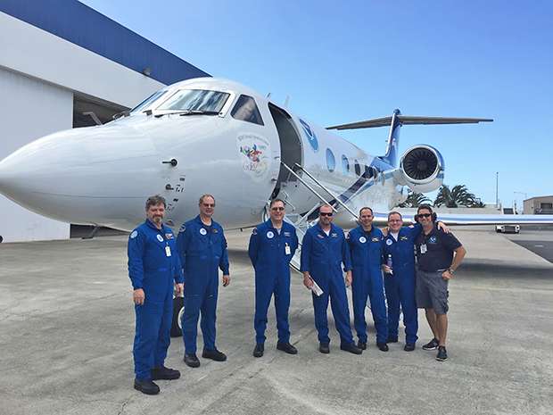
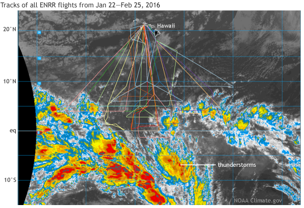
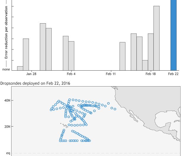
- 23 research flights with the NOAA Gulfstream-IV (G-IV) aircraft out of Honolulu, Hawaii with a suite of meteorological sensors, and deployed dropsondes (instruments that are literally dropped out airplanes to gather data) from mid-January to mid-March.
- Twice-a-day radiosonde (as opposed to instruments dropped out of airplanes, radiosondes have their instruments strapped to large balloons) launches on Kiritimati (Christmas) Island, approximately 1,340 miles south of Honolulu from late January through March.
- 8-times daily radiosonde launches from the NOAA Research Ship Ronald H. Brown while on a cruise from mid-February to mid-March to check out a buoy system already in place across the Pacific, the Tropical Atmosphere Ocean (TAO). (A tricky responsibility, especially in high winds.)
Three 24-hour research flights with the NASA Global Hawk (an unmanned aircraft that can travel for 24 hours straight at high-altitude) in February.
Twice a day, scientists in Boulder, Colorado, at the NOAA Earth System Research Laboratory Physical Sciences Division, met to brief the Gulfstream team in Hawaii on where to deploy dropsondes. The focus of the Gulfstream flights was to circle massive thunderstorm systems in the central and eastern tropical Pacific north of the equator to measure how air spreads out at the top of the thunderstorms. Down the line, this can influence where storms track in the mid-latitudes.
Were these new observations actually useful?
Yes! For the period of the field campaign, NASA found that for all tropical observations, the dropsondes released from the field campaign reduced the forecast error more than any other observation type. Also, the total 24-hour global forecast error in the model was substantially reduced, comparable to the total impact of the tropical radiosonde network and major satellite systems.
The dropsonde observations were able to improve forecasts by reducing errors in the poorly observed tropical eastern Pacific. This is an indication that the additional information provided by the dropsondes will improve the skill of forecasting El Niño teleconnections.
Now that the campaign is over, the observations that were taken will be used to identify model biases that limit the skill of forecasting West Coast precipitation events over the Jan-March period. Also, we'll study how improving the initial state of the atmosphere in the models during El Niño can impact forecast skill. The campaign was an invaluable experience to test hypotheses of tropical-extratropical interactions that determine precipitation along the west coast of the US in real time.
More information: Gelaro, R. and Zhu Y. 2009. Examination of observation impacts derived from observing system experiments (OSEs) and adjoint models. Tellus 61A, 179–193.
Provided by NOAA Headquarters


