Satellites see Hurricane Joaquin moving through Northern Atlantic

NASA and NOAA satellites have been watching Hurricane Joaquin move to the northeast through the northern Atlantic Ocean. Although Joaquin is moving away from the U.S. and Canada it is still generating dangerous surf conditions.
The National Hurricane Center noted on October 6 that "Swells generated by Joaquin will continue to affect Bermuda the next day or so. Swells are affecting much of the mid-Atlantic and northeast coast of the United States and are increasing along coastal areas of Atlantic Canada, and these swells are expected to continue for the next day or two. Life-threatening surf and rip current conditions are likely in association with these swells."
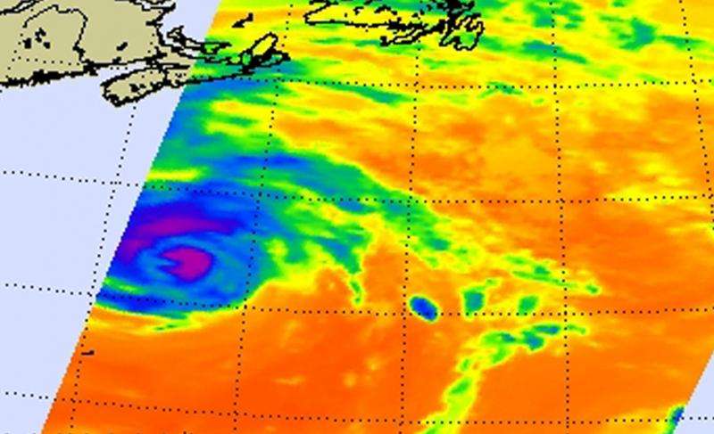
On October 6 at 0529 UTC (1:29 a.m. EDT) NASA's Aqua satellite passed over Hurricane Joaquin and the AIRS instrument aboard captured infrared data that revealed cloud top temperatures. AIRS data was made into a false-colored image at NASA's Jet Propulsion Laboratory in Pasadena, California. AIRS showed powerful thunderstorms around the center with cloud top temperatures near -63F/-53C.
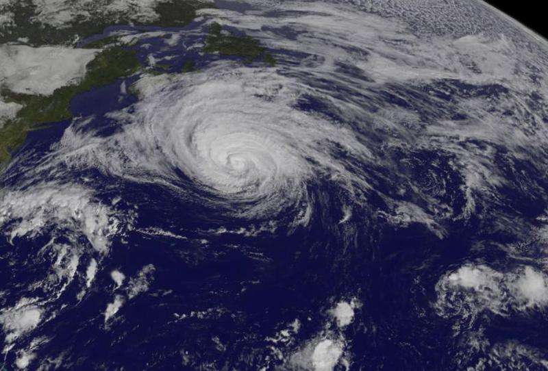
A visible image from NOAA's GOES-East satellite showed Hurricane Joaquin at 1445 UTC (10:45 a.m. EDT) far to the east of New England. The storm still appeared rounded with bands of thunderstorms surrounding the low-level center. The image was created by NASA/NOAA's GOES Project at NASA's Goddard Space Flight Center in Greenbelt, Maryland.
At 11 a.m. EDT (1500 UTC), the center of Hurricane Joaquin was located near latitude 38.3 North, longitude 59.6 West. Joaquin was moving toward the northeast near 18 mph (30 kph). The National Hurricane Center expects a turn toward the east-northeast with some further increase in forward speed expected later today through Wednesday, October 7. Maximum sustained winds have decreased to near 80 mph (130 kph) and additional slow weakening is forecast.

Joaquin is expected to become extratropical late Wednesday, October 7. That's because of increasing southwesterly wind shear and cooler waters along Joaquin's track. In addition, cooler and drier air to the north of the storm is expected to start affecting the circulation over the next two days, further weakening the storm.
The National Hurricane Center expects the storm to speed east across the Atlantic where it may affect Ireland and the United Kingdom by October 10.
Provided by NASA's Goddard Space Flight Center


