NASA identifies Tropical Storm Dujuan's strongest side

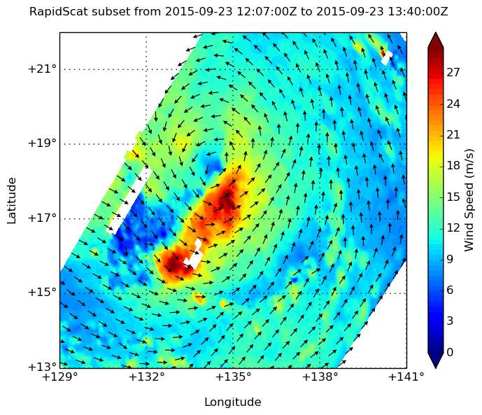
The RapidScat instrument that flies aboard the International Space Station is an important tool for forecasters because it identifies where the strongest winds are located in a tropical cyclone when it is over open waters. RapidScat saw that Tropical Storm Dujuan's strongest side was in the southeastern quadrant.
On Sept. 23 at 4:11 p.m. EDT, RapidScat saw Tropical Storm Dujuan east of the Philippines and its strongest winds (red) were south and southeast of the center. Maximum sustained winds in both areas were as strong as 30 meters per second (67 mph/108 kph).
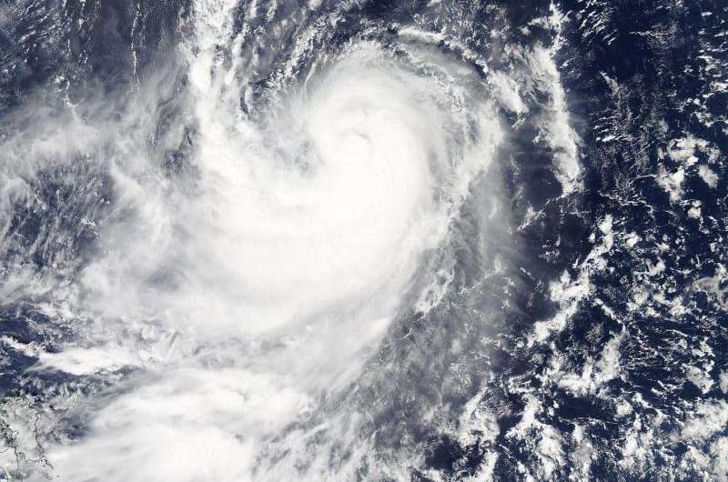
At 04:40 UTC (12:40 a.m. EDT) on Sept 24, the Moderate Resolution Imaging Spectroradiometer or MODIS instrument aboard Aqua captured a visible image of Tropical Storm Dujuan. The MODIS image showed Dujuan has the signature comma shape of a tropical cyclone.
Images from RapidScat are created at NASA's Jet Propulsion Laboratory in Pasadena, California, and MODIS images are created at NASA's Goddard Space Flight Center in Greenbelt, Maryland.
At 11 a.m. EDT (1500 UTC), the center of Tropical Storm Dujuan was located near latitude 18.6 North, longitude 132.0 East. Dujuan is moving toward the west-southwest near 3 knots (3.4 mph/5.5 kph). Maximum sustained winds were near 55 knots (63.2 mph/ 101.9 kph) and Dujuan is expected to become a typhoon in the next couple of days peaking on September 27 with maximum sustained winds near 115 knots (132 mph/213 kph). Dujuan is moving to the north-northwest and is expected to track near Ishigakikima Island, Japan on September 27, and pass just north of Taiwan before making landfall in southeastern China on September 29. For updated forecast tracks visit the Joint Typhoon Warning Center page: http://www.usno.navy.mil/JTWC/.

Provided by NASA's Goddard Space Flight Center


