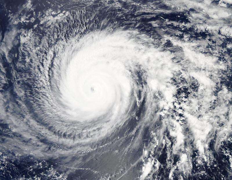
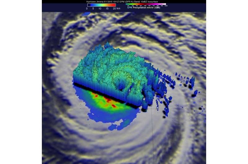
GPM sees Hurricane Jimena's intense eyewall

NASA's Global Precipitation Measurement or GPM core satellite passed over Hurricane Jimena and saw an intense eyewall with heaviest rainfall occurring in the northern and eastern sides of the storm.
GPM captured an image of Hurricane Jimena at 10:11 UTC (3:11 a.m. PDT) on September 1, 2015. GPM showed that Jimena was still a very strong system. An intense eyewall was seen around the northern half the still visible eye, though the southern half of the eyewall appeared to be eroded away. GPM saw a nearly circular rain band surrounding the center that completely wrapped around the storm and appears to be a possible secondary eyewall trying to form outside of the inner eyewall. Other tightly curved rainbands north and east of the center reflect Jimena's still powerful cyclonic circulation.
At the time of the GPM image the center of the storm was located about 1,060 miles east of Hilo, Hawaii, and NHC estimated Jimena's maximum sustained winds to be at 130 mph. GPM is a joint mission between NASA and the Japanese space agency, JAXA.
By September 2 at 1500 UTC (11 a.m. EDT), Jimena's eye was less apparent in infrared satellite imagery, which NOAA's Central Pacific Hurricane Center noted may be because the eyewall is in a replacement cycle (another eye wall is building behind the current eyewall, which is eroding).

At that time the center of Hurricane Jimena was located near latitude 17.7 north and longitude 142.8 west. That's about 815 miles (1,315 km) east of Hilo, Hawaii and 1,015 miles (1,630 km) east of Honolulu.
Maximum sustained winds were near 110 mph (175 kph) making Jimena a category three hurricane on the Saffir-Simpson Hurricane Wind Scale. Gradual weakening is forecast through Thursday night, September 2.
Jimena was moving toward the west-northwest near 8 mph (13 kph) and is expected to continue in that direction before turning to the northwest on September 3.
The hurricane is close enough to the Hawaiian Islands to cause large ocean swells. CPHC noted that large swells from Hurricane Jimena will produce hazardous surf along east facing shores of the main Hawaiian Islands. The surf will build today (September 2) and continue through the weekend of September 5 and 6).
CPHC noted that environmental conditions are expected to produce only slow weakening during the next 48 hours. After 72 hours, cooler sea surface temperature values and increasing shear are expected to produce more rapid weakening.
Provided by NASA's Goddard Space Flight Center


