NASA sees Hurricane Jimena's large eye

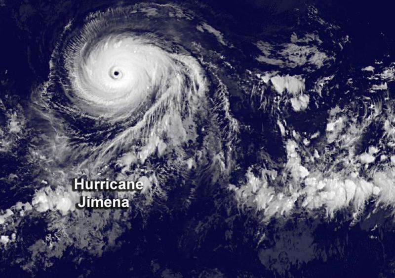
NASA's Aqua satellite and NOAA's GOES-East satellites provided views of Hurricane Jimena that showed it maintained a large eye and powerful thunderstorms around it. On August 31, Jimena continued moving through the Eastern Pacific as a major hurricane.
An infrared image from NOAA's GOES-West satellite on August 31 at 8:00 a.m. EDT revealed that Hurricane Jimena's wide-eye continued to be cloud free. The GOES image also showed thick bands of powerful thunderstorms circling the eye.
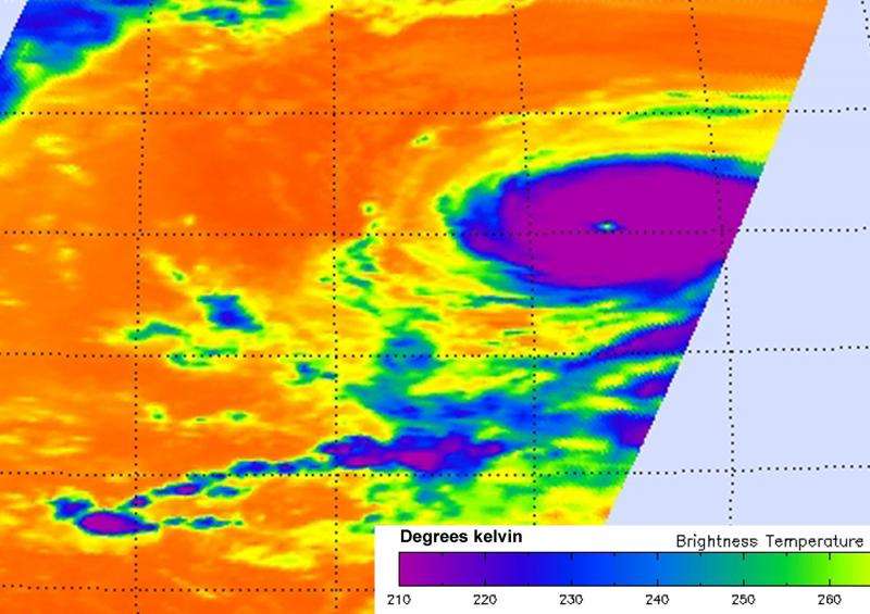
The Atmospheric Infrared Sounder or AIRS instrument aboard Aqua gathers infrared data that shows temperatures. Data taken on August 31 at 10:59 UTC (6:59 a.m. EDT) was made into a false-colored image that revealed powerful thunderstorms with cloud top temperatures in excess of -81F/-63C/210K around the center of Hurricane Jimena. NASA research has shown that thunderstorms with cloud tops that cold and high in the troposphere have the potential to generate heavy rainfall.
The AIRS data also showed that sea surface temperatures around Jimena were warmer than 28 degrees Celsius (82.4 Fahrenheit). Warmer sea surface temperatures can help a storm intensify because they can increase evaporation and thunderstorm development. As the warm, moist air evaporates and rises, it condenses into clouds. In a hurricane, air rotates inward toward the storm's center then rises to higher altitudes. As the air rises it cools and condenses into clouds and rain, releasing heat (called latent heat). It is the cycle of evaporation and condensation powers a tropical cyclone.

NHC forecaster Cangialosi noted "Jimena is expected to more or less maintain its intensity during the next day or so while it remains over 28C water and in a very low wind shear environment." Tropical cyclones need sea surface temperatures of at least 26.6C/80F to maintain intensity.
NOAA's National Hurricane Center (NHC) on-line discussion said "the eye of the hurricane remains distinct and has a diameter of about 20 nautical miles, and the convective pattern is slightly asymmetric with cloud tops slightly warmer west of the eye.
On August 31 at 1500 UTC (11 a.m. EDT/5 a.m. HST), the center of Hurricane Ignacio was located near latitude 15.6 North and longitude 135.3 West. That's about 1,330 miles (2,145 km) east of Hilo, Hawaii. The estimated minimum central pressure is 936 millibars.
NHC reported Jimena's maximum sustained winds were near 150 mph (240 kph). Jimena is a category 4 hurricane on the Saffir-Simpson Hurricane Wind Scale. Little change in strength is expected during the next day or so, followed by slow weakening.
Jimena was moving toward the west near 16 mph (26 kph) and is forecast to turn to the west-northwest with a decrease in forward speed during the next couple of days.
For updated forecasts, visit NOAA's NHC website: http://www.nhc.noaa.gov.
Provided by NASA's Goddard Space Flight Center


