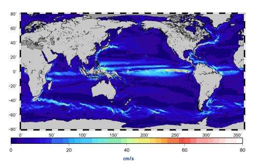
ESA image: Ocean currents from GOCE

The ocean currents and their speeds (in cm/s) derived from GOCE data.
During the mission's final year, its super-low orbit was lowered even further to obtain improved measurements of Earth's gravity field, from which information on ocean currents was derived.
Buoys floating in the oceans were used to validate the above map, proving that this GOCE-based model is more accurate than any other model based on space-based data to date.
Provided by European Space Agency


