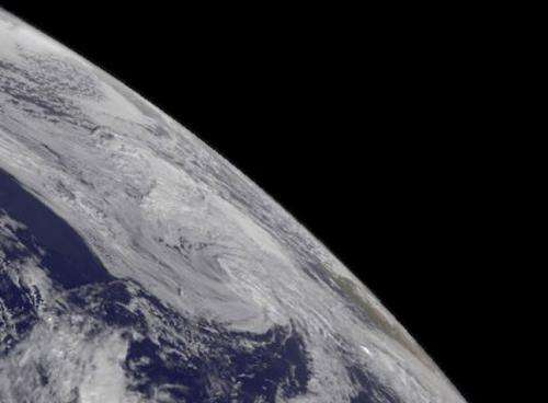
Extra-Tropical Storm Melissa spinning into history

The National Hurricane Center issued their final advisory on Extra-Tropical Storm Melissa as it spins toward to Azores Islands and weakens.
The final advisory on Melissa was issued on November 22 at 0300 UTC, or November 21 at 10 p.m. EST. At that time, Melissa still had maximum sustained winds near 45 knots/51.7 mph/83.3 kph, but its core had changed from warm to cold, like a typical mid-latitude low pressure system. Melissa was about 265 nautical miles/305 miles/490.8 km north-northwest of the Azores near 40.9 north and 32.1 west and headed to the east northeast at 24 knots/27.6 mph/44.4 kph.
A GOES-East satellite image from Nov. 22 at 1445 UTC/9:45 a.m. EST/1:45 p.m. Azores local time showed extra-tropical storm Melissa in the Eastern Atlantic near the Azores Islands.
Regional warnings were dropped for Azores on November 22. At 12 p.m. EST/4 p.m. local time in the Azores, Angra Do Heroismo and Lajes both reported sustained winds near 25 mph/40.2 kph from the west-northwest. Ponta Delgada and Santa Maria both reported winds from the west near 21 mph/33.8 kph. None of those areas reported rain at the time of the observations.
Melissa is expected to continue moving toward the east-northeast and weaken over the next day or two.
Provided by NASA's Goddard Space Flight Center


