NASA observes another tropical depression birth in northwestern Pacific

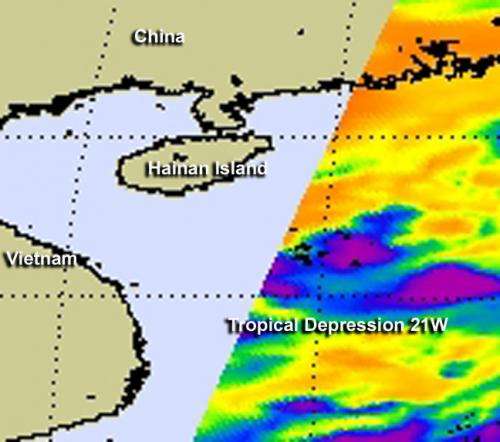
The twenty-first tropical depression of the northwestern Pacific Ocean was born as a NASA satellite flew overhead on Oct. 1, capturing its "baby picture" in infrared light.
On Monday, Oct. 1 at 1500 UTC (11 a.m. EDT), Tropical Depression 21W (TD21W) had maximum sustained winds near 25 knots. It was centered about300 nautical miles south of Hong Kong, near 17.4 North latitude and 114.8 East longitude. TD21W has tracked northward at 5 knots and is expected to curve to the northwest and west.
On Oct. 1, 2012, infrared imagery from the Atmospheric Infrared Sounder (AIRS) instrument aboard NASA's Aqua satellite shows that the center of circulation is well-defined and the strongest thunderstorms are building in the southeastern quadrant of the storm and wrapping into the center.
The system has been quasi-stationary over the past 12 hours, because it is in a weak steering environment with nothing to push the storm in any direction.
Forecasters at the Joint Typhoon Warning Center expect that Tropical Depression 21W will start moving to the west and approach the central Vietnam coast by Oct. 6 or Oct. 7.
Provided by NASA's Goddard Space Flight Center


