This article has been reviewed according to Science X's editorial process and policies. Editors have highlighted the following attributes while ensuring the content's credibility:
fact-checked
proofread
Enhancing plant growth tracking with satellite image fusion techniques

The capacity to accurately monitor the timing of vegetation growth phases, known as land surface phenology (LSP), at fine spatial scales is critical for understanding ecosystem functions and managing natural resources. Despite advancements, the sparsity of high-resolution satellite data caused by cloud cover and limited revisit times complicates this task.
A study, published in the Journal of Remote Sensing assesses the accuracy of two spatiotemporal data fusion algorithms, Spatial and Temporal Adaptive Reflectance Fusion Model (STARFM) and Simultaneously generate Full-length normalized difference vegetation Index Time series (SSFIT), in extracting spring phenological dates at fine scales. These algorithms aim to reconstruct high-resolution and cloud-free time series data for improving the detection accuracy of the start of the growing season (SOS) across heterogeneous landscapes.
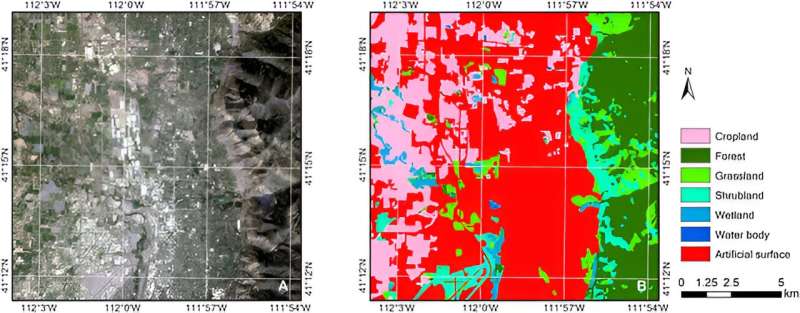
Utilizing Harmonized Landsat Sentinel-2 (HLS) and Moderate Resolution Imaging Spectroradiometer (MODIS) data for a simulation study in Ogden, Utah, the research team evaluated the STARFM and SSFIT algorithms against traditional interpolation methods in reconstructing high-quality Enhanced Vegetation Index (EVI2) time series to accurately identify the SOS.
The study demonstrated that these algorithms significantly improve the accuracy of phenological dates, especially when limited cloud-free Landsat images are available during crucial growth periods.
The research addressed the challenges of cloud cover and sparse high-resolution image capture, vital for detailed vegetation growth monitoring. By merging frequent MODIS observations with detailed, albeit infrequent, HLS data, the team crafted synthesized, cloud-free images that combine high resolution with regular capture intervals.
Professor Xiaolin Zhu, the corresponding author, emphasizes the necessity of accurately capturing the phenological stages to mitigate ecological and agricultural risks associated with climate variability. "Our research seeks to bridge the gap in phenology monitoring by leveraging the strengths of both coarse and fine-resolution satellite imagery through advanced data fusion techniques."
This research highlights the critical role of data fusion techniques in advancing land surface phenology monitoring by addressing the challenges of cloud cover and coarse-resolution satellite images.
By enhancing the accuracy of vegetation stage detection, the study supports improved environmental management and climate adaptation efforts. It showcases the integration of satellite data as a significant leap forward in phenological research and practical applications.
More information: Jiaqi Tian et al, Effectiveness of Spatiotemporal Data Fusion in Fine-Scale Land Surface Phenology Monitoring: A Simulation Study, Journal of Remote Sensing (2024). DOI: 10.34133/remotesensing.0118
Provided by TranSpread


