This article has been reviewed according to Science X's editorial process and policies. Editors have highlighted the following attributes while ensuring the content's credibility:
fact-checked
peer-reviewed publication
trusted source
proofread
Glaciers rise, fall and melt with tides

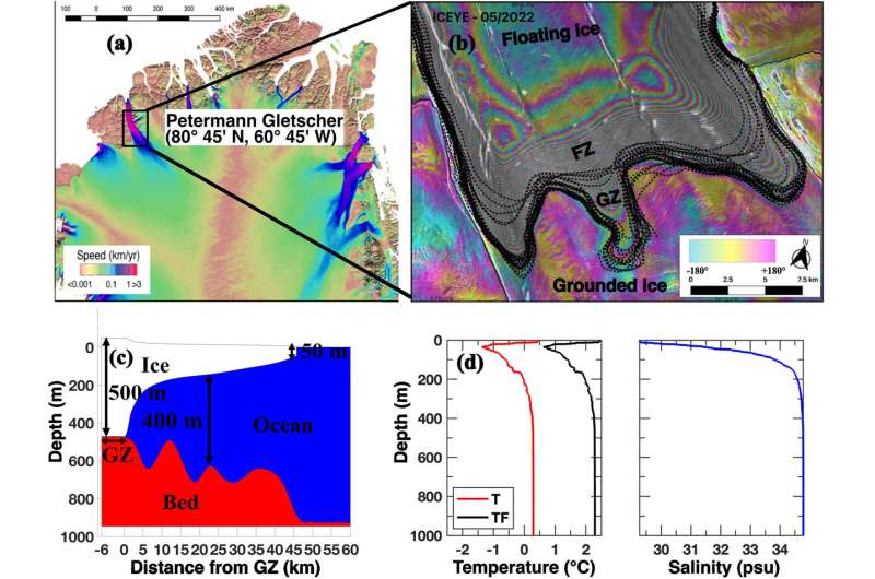
Glaciers that extend off the edges of landmasses move much more than scientists anticipated, R. Gadi and colleagues have found. The boundary between the grounded part of a glacier and the point at which the glacier extends past the landmass to float in water is called the grounding line or, because this boundary can be wide and amorphous, the grounding zone.
Grounding zones were once thought to remain mostly stationary while tides rose and fell, but researchers now know that they can shift by kilometers with the rhythm of the ocean—about 10 times as much as previously realized. When the tide rises, glaciers rise with it, and the gap between the ice and the landmass beneath increases. Seawater rushes into this space, where it can melt glaciers from the bottom up.
Researchers used satellite data to measure how far Petermann Glacier—an outcropping of ice in northern Greenland—moved during tides, then used an ocean numerical model called the MIT General Circulation Model (MITgcm) to estimate how this movement has influenced melting. The paper is published in the journal Geophysical Research Letters.
The model suggested that bottom-up melting thinned Petermann Glacier by about 140 meters between 2000 and 2020. As the glacier thinned and the length of its grounding area grew, it began to rise and fall even more in response to tides. Because of this, the average melt rate likely increased from about 3 meters per year in the 1990s to 10 meters per year in the 2020s. The model indicates that the growth of the grounding zone and the accompanying rise in seawater intrusion play a greater role in increased melt than warming ocean waters do.
More information: R. Gadi et al, Modeling Ice Melt Rates From Seawater Intrusions in the Grounding Zone of Petermann Gletscher, Greenland, Geophysical Research Letters (2023). DOI: 10.1029/2023GL105869
Journal information: Geophysical Research Letters
Provided by American Geophysical Union
This story is republished courtesy of Eos, hosted by the American Geophysical Union. Read the original story here.


