This article has been reviewed according to Science X's editorial process and policies. Editors have highlighted the following attributes while ensuring the content's credibility:
fact-checked
peer-reviewed publication
trusted source
proofread
Tagged turtles and 3D ocean current maps reveal loggerheads' navigation mechanisms

A study published in the Journal of The Royal Society Interface has revealed new insights into the navigational strategies of sea turtles during their pre-reproductive migration.
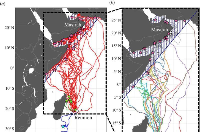
Using data from 25 juvenile loggerhead turtles, researchers have uncovered a remarkable map and compass strategy not previously seen in this turtle species.
This novel strategy involves straight-line swimming at a steady speed of about 0.5 meters per second, interspersed with occasional course corrections.
What makes this discovery even more significant is the methodology used: The researchers considered three-dimensional ocean currents, rather than the more commonly used surface current approach.
This novel approach reveals a common, cross-species, open-ocean navigation mechanism and highlights the crucial role of diving behavior in understanding the spatial ecology of sea turtles.
Sea turtles navigate oceans using their internal map-and-compass orienteering abilities.
Combining tracking data from 25 late-juvenile loggerhead turtles migrating from Reunion Island in the Indian Ocean with 3D models of ocean currents, researchers have mapped for the first time how the turtles combine straight-line swimming with occasional course corrections to account for ocean currents.
This strategy, hypothesized in green and hawksbill turtles, may be a common ocean-navigation mechanism across all turtle species.
Correction Note (12/14/2023): Reunion Island is located in the Indian Ocean, not the Pacific.
More information: Antoine Laforge et al, Uncovering loggerhead ( Caretta caretta ) navigation strategy in the open ocean through the consideration of their diving behaviour, Journal of The Royal Society Interface (2023). DOI: 10.1098/rsif.2023.0383
Journal information: Journal of the Royal Society Interface
Provided by The Royal Society


