This article has been reviewed according to Science X's editorial process and policies. Editors have highlighted the following attributes while ensuring the content's credibility:
fact-checked
reputable news agency
proofread
How hard will Hurricane Lee hit New England? The cold North Atlantic may decide that

New England is known for its fickle weather, powerful nor'easters and blizzards. Destructive hurricanes, however, are relatively rare and typically don't pack the same punch as tropical cyclones that hit the Southeast.
Hurricanes usually lose some steam, becoming tropical storms, or extratropical storms, in northern waters.
GEOGRAPHY MATTERS
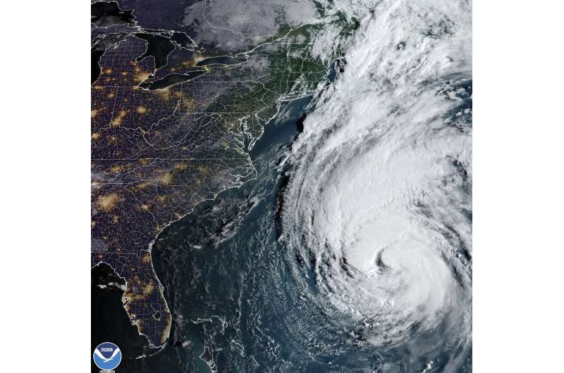
New England, awaiting the arrival of Hurricane Lee, is usually protected from the worst of a hurricane's wrath by the cold waters of the North Atlantic, and that's expected to help reduce Lee to a tropical storm by the time it arrives Saturday.
A number of factors determine the path and strength of a hurricane. But the warm waters that can strengthen a hurricane are typically south of Cape Cod. North of there, the Atlantic waters are much colder.
That doesn't mean storms aren't dangerous in New England.
The Great New England Hurricane of 1938 brought gusts as high as 186 mph (300 kph) and sustained winds of 121 mph (195 kph) at Massachusetts' Blue Hill Observatory. And the damage isn't always confined to the coast. In 2011, a weakening Hurricane Irene was downgraded to a tropical storm but produced historic flooding in Vermont, causing more than $800 million in estimated damage.
DOWN EAST MAINE

While Lee will cause trouble across New England, it's tracking toward Down East Maine—as the state's easternmost regions are known—and Atlantic Canada.
The last time Maine was under a hurricane watch was in 2008 for Hurricane Kyle, a tropical storm when it skirted past the state.
The last hurricane to make landfall in Maine was Hurricane Gerda, which hit Eastport in 1969. Hurricane Bob also had a big impact in 1991, but it was downgraded to a tropical storm just as it arrived in Maine.
Again, those cold waters are expected to reduce Lee's potential for trouble. But the state is still expecting 20-foot (6-meter) waves and winds gusting to 70 mph (112 kph), along with more rain in a waterlogged region.
SOUTHERN STORMS
The most powerful hurricanes in history in the Atlantic have made landfall in the Caribbean, Mexico and Southern U.S. That's because the warm water tends to fuel the storms, giving them strength.
The Galveston Hurricane of August 1900 was the deadliest hurricane in U.S. history, claiming thousands of lives. Hurricane Katrina laid waste to much of southeast Louisiana and Mississippi's Gulf Coast in 2005. Superstorm Sandy in 2012 caused damage across more than a dozen states, and wreaked havoc in the Northeast when it made landfall near Atlantic City, New Jersey.

WARMING OCEANS
It's not clear what the future holds when it comes to cyclones in New England. But science suggests they could become more troublesome.
The Gulf of Maine is warming faster than the vast majority of the world's oceans. In 2022, the Gulf of Maine recorded the second-warmest year on record, beating the old record by less than half a degree Fahrenheit. The average sea surface temperature was 53.66 degrees (12 degrees Celsius), more than 3.7 degrees above the 40-year average, the scientists said.
That warming trend could allow hurricanes approaching New England to be slower to weaken at some point in the future. Warming waters could create even more powerful storms to the south, as well.
© 2023 The Associated Press. All rights reserved. This material may not be published, broadcast, rewritten or redistributed without permission.


