This article has been reviewed according to Science X's editorial process and policies. Editors have highlighted the following attributes while ensuring the content's credibility:
fact-checked
peer-reviewed publication
proofread
Researchers create detailed map of Waiwhetu Aquifer, technique could improve worldwide access to coastal freshwater

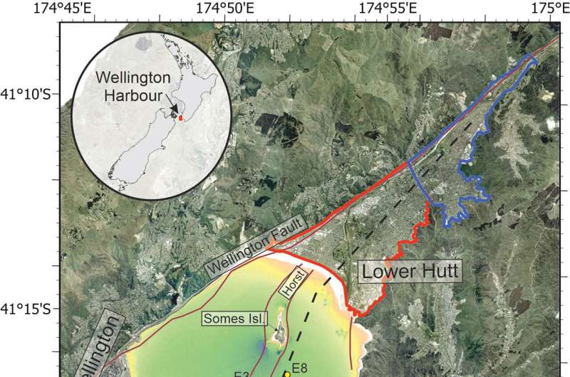
For the first time, NIWA used several techniques to map and understand the Waiwhetu Aquifer. This is a reservoir of drinking water that lies beneath the Hutt Valley and Wellington Harbor, and it releases freshwater from deep under the seabed via natural springs.
NIWA Marine Geoscientist Dr. Joshu Mountjoy designed the study. He said it was motivated by the lack of knowledge about large coastal aquifers around New Zealand, with Wellington Harbor being the perfect test site.
"Up to 70% of Wellington's drinking water comes from the Waiwhetu Aquifer. A lot of work has been done over the years to understand where the aquifers are and where the freshwater is, but until now, we didn't know where in the seabed the freshwater was leaking through.
"Due to Wellington's vulnerability to earthquakes, ensuring access to drinking water is a priority in case a source is cut off or damaged, and the Waiwhetu Aquifer is a critical resource for our resilience," said Dr. Mountjoy.
Natural freshwater springs are located in the ocean as well as on land. They provide a window into submarine aquifers but finding them is challenging.
To bypass costly drilling, NIWA showed that other techniques can be harnessed to track ocean-based freshwater springs and sample the water, helping scientists to understand a huge amount about submarine aquifers.
"We used every tool we had available to understand the nature of these natural springs, including acoustic measurements, seafloor samples, remotely operated vehicles, and seawater sampling. We wanted to see which techniques worked best with a mind to apply them to other locations in the future," said Dr. Mountjoy.
Through many novel methods, NIWA recorded video footage and acoustic soundings of freshwater flowing out of various pockmarks in the Harbor. There are several hundred of these, the largest of which are more than 100m across.
"We managed to create a detailed map of freshwater springs in the Harbor, which will be important for managing the aquifer as a drinking water resource for Wellington.
"We can start applying the techniques we used here to find freshwater leaking out of other aquifers, such as in Marlborough, Canterbury, and Hawke's Bay. These are barely understood beyond the coastline but are vitally important.
"We are at the beginning of understanding offshore groundwater systems around the world, which that might be the most important resource some countries have. The implications are huge, especially for drought prone and water scarce areas," said Dr. Mountjoy.
More information: Jasper J. L. Hoffmann et al, Fresh submarine groundwater discharge offshore Wellington (New Zealand): hydroacoustic characteristics and its influence on seafloor geomorphology, Frontiers in Marine Science (2023). DOI: 10.3389/fmars.2023.1204182
Journal information: Frontiers in Marine Science
Provided by NIWA


