This article has been reviewed according to Science X's editorial process and policies. Editors have highlighted the following attributes while ensuring the content's credibility:
fact-checked
proofread
Satellite-based disaster early warning systems can improve evacuation measures in remote Asian communities

Communities in Bangladesh, Bhutan, and Mongolia, where conventional ground-based telecommunication systems have limited reach, are prone to disruption during extreme disaster events, and warning information is often unclear, distorted, or delayed. Researchers have investigated the factors affecting the dissemination of early warning information and how these hinder community evacuation. Their study was published on 27 April 2023 in the journal Emergency Management Science and Technology.
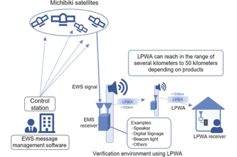
These communities are vulnerable to a range of natural hazards, including tropical cyclones in Bangladesh, Glacial Lake Outburst Floods (GLOFs) in Bhutan, and dzuds (extremely harsh winters) in Mongolia. The research team assessed the effectiveness of current early warning systems and presented a case for utilizing the QZSS-EWS to improve these systems.
Through three case studies, the research underscored a real need to augment the existing warning systems in these geographically challenging areas. For instance, in Bangladesh, the CPP can be the entry point for the operationalization of QZSS-EWS; in Bhutan, it may be operationalized by integrating it into the GLOF early warning system and subsequently update its SOP to include the functions of QZSS-EWS; and in Mongolia, it could be used alongside Dzud Risk Maps.
Such a space-based system, unaffected by ground-based network overloads or damage during extreme disaster events, could provide clearer, direct alerts to individuals and communities at risk, improving evacuation procedures and potentially saving lives and livelihoods.
However, the study warns that this technological solution alone is not sufficient. "QZSS could significantly improve the effectiveness of disaster early warning systems, but it is also crucial that policymakers undertake subsequent policy and practical actions to upgrade these systems based on lessons from past experiences and future challenges," the researchers noted.
This includes updating standard operating procedures and guidelines for implementing early warning systems, conducting regular performance assessments, and upgrading necessary tools and equipment. Also critical is community capacity building, such as regular evacuation drills and training on using new technology like QZSS receivers.
Overall, the research underlines the need for a holistic and inclusive approach that doesn't leave at-risk communities behind. Implementing QZSS and similar technologies is a valuable step, but to facilitate effective evacuation, it must be accompanied by consistent and committed policy action and practical on-the-ground measures.
More information: Gerald Potutan et al, Addressing early warning challenges using satellites to improve emergency evacuation, Emergency Management Science and Technology (2023). DOI: 10.48130/EMST-2023-0004
Provided by Emergency Management Science and Technology


