This article has been reviewed according to Science X's editorial process and policies. Editors have highlighted the following attributes while ensuring the content's credibility:
fact-checked
trusted source
proofread
NASA rockets to search for hurricane-like swirls in Earth's upper atmosphere

A NASA rocket team is on the hunt for giant hurricane-like swirls in our upper atmosphere. These swirls, or vortices, may be key to upper atmospheric weather patterns that affect the entire globe. The Vorticity Experiment, or VortEx mission, is readying for a launch on March 17, 2023, from the Andøya Space Center in Andenes, Norway.
If you've ever stood atop a mountain or tall building, you've probably noticed how gusty it gets up there. High-altitude winds are factored into architects' plans and pilots' routes, but their influence on our planet extends well beyond the typical human domain. These winds are sources of buoyancy waves: giant pulses of energy that drive changes at Earth's interface to space.
Buoyancy waves are common occurrences on Earth. "They could come from approaching storm fronts, or winds hitting the mountains and being sent upwards," said Gerald Lehmacher, a professor of physics at Clemson University in South Carolina and principal investigator for the Vorticity Experiment, or VortEx, mission.
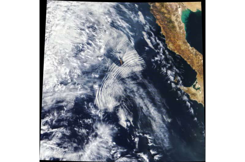
Buoyancy waves form when a gust or disturbance suddenly pushes denser air upwards into a lower pressure region, creating an oscillation as the atmosphere tries to return to equilibrium. These oscillations lead to waves that propagate away from the disturbance, similar to ripples in a pond.
Although buoyancy waves are common, their effects higher up in the atmosphere are still poorly understood.
"In the broadest sense, this experiment is about learning about the fate of buoyancy waves at the edge of space," Lehmacher said.
VortEx is looking for one fate in particular: vortices. As buoyancy waves move upwards and pass through stable layers of our atmosphere, computer models have shown they can form giant swirls of air.

"They could turn into whirls—this could be happening everywhere in the atmosphere, but we simply don't have the measurements to know," Lehmacher said.
Thought to stretch tens of miles from one side to the other, these vortices are too big to measure with conventional approaches. Lehmacher designed VortEx to overcome this limitation, measuring winds at widely separated locations.
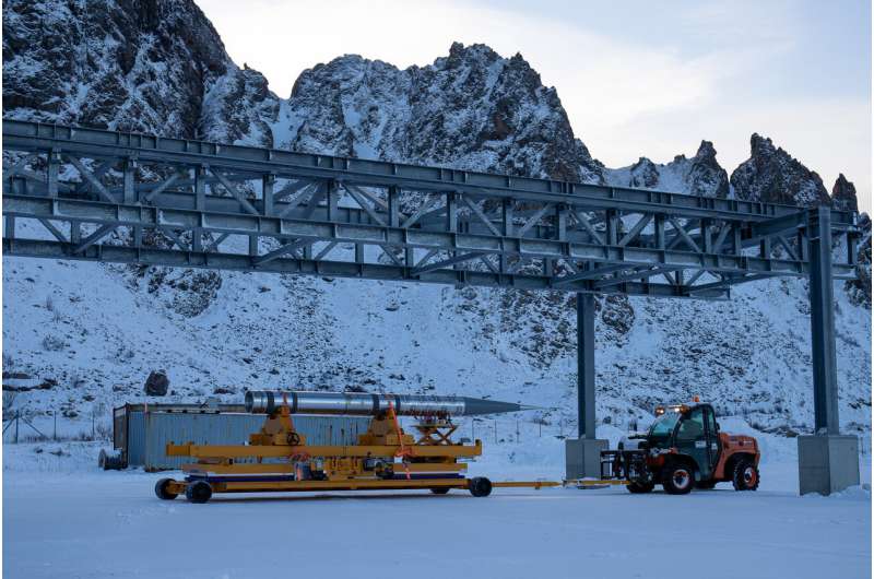
The mission will use four rockets, launched two at a time. Each pair consists of one high-flyer and one low-flyer, launched a few minutes apart. The high-flyer, which will peak at approximately 224 miles (360 kilometers) altitude, will measure the winds. The low-flyer, reaching approximately 87 miles (140 kilometers) altitude, will measure air density, which affects how vortices form. Both rockets will make their measurements for a few minutes before falling back down into the Norwegian Sea.
To measure winds, the high-flying rocket will release luminescent clouds like those used in firework shows, tracking their motions from the ground. Most experiments of this type release the clouds from the rocket's payload. But to spread out the clouds to reveal larger-scale patterns, VortEx will eject four subpayloads at a time, each reaching a distance of about 25 miles (40 kilometers) from the rocket before releasing its own clouds.
This will happen at four different instances during the flight, for a total of 16 clouds at different heights and distances, which will help show large-scale patterns. Watching these clouds move, the VortEX team will look for any telltale signs of swirling. The team will then repeat the experiment, launching the second pair of rockets in different weather conditions either later that night or a few days later (depending on when conditions are favorable).
The VortEx team will also be watching for buoyancy waves from below. The Alomar Observatory, run by the Andøya Space Center in Andenes, Norway, has the necessary ground-based radar and imaging systems to detect buoyancy waves happening in real time. The location also features the Scandinavian mountains, which run the length of Norway from north to south. They are a regular source of buoyancy waves as winds rush against the mountains and shoot up into the sky.
If VortEx finds vortices, it would be a key step forwards in understanding upper atmospheric weather, which affects GPS navigation and communication signals. Current computer models of upper atmospheric weather still struggle to account for the effects of buoyancy waves. Vortices could be the key, Lehmacher says, because they are more predictable than buoyancy waves themselves.
"Vortical structures follow certain universal rules that we could put into models to make them work at these scales," Lehmacher said. "Instead of tracking individual buoyancy waves, you would just describe them with a spectrum of vortices."
Provided by NASA's Goddard Space Flight Center


