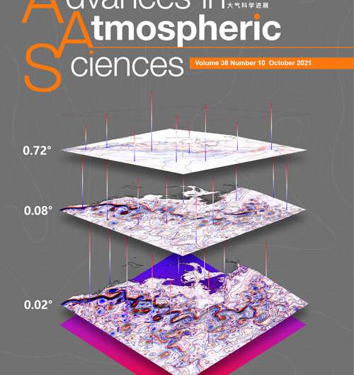
Higher resolution in ocean models: Is it worth it?

Realistic ocean models require significant computing power, especially as resolution increases from scales of tens of kilometers to a single kilometer. These models are used for short-term and seasonal weather predictions, as well as in long-term climate simulations, all of which are used routinely for decision making. The better the resolution, the better potential dangers can be understood and mitigated, resulting in a better situation for all… right?
That's the question Eric P. Chassignet and Xu Xiaobiao from Florida State University's Center for Ocean-Atmospheric Prediction Studies asked in a review study published on July 31 in Advances in Atmospheric Sciences.
"Increasing the resolution allows you to resolve more and more small-scale ocean features, and the question that then arises is whether there is corresponding improvement in the overall representation of the ocean circulation and at what cost," said Chassignet, who leads the center. "In other words, what is the optimal ratio of resolution and computational resource that truly leads to a better understanding of ocean physics and the Earth's climate?"
Coarse resolution models, with a horizontal resolution on the order of 100 kilometers, are mostly used for climate applications and the ocean currents in this class of models tend to be broad and steady. When the model's resolution is increased to approximately 10 kilometers, the currents become unstable, forming swirling ocean mesoscale eddies, somewhat like storms in the atmosphere. Just like storms, they have an impact on other components of the earth system.
However, resolving the mesoscale eddies is not enough to accurately model the ocean circulation, according to Chassignet. His team determined that increasing resolution to approximately a kilometer, which makes the model able to simulate smaller, sub-mesoscale eddies, shifted their model of the Gulf Stream to a realistic rendition that more closely resembled actual observations.
"We argue that resolving sub-mesoscale features is as significant a regime shift as resolving the mesoscale eddies," Chassignet said.
Yet the resolution comes at a price and with a concern, since each time the model's resolution is increased by a factor of two, it requires increasing computational power by a factor of 10. According to Chassignet, more work is needed to better understand whether increasing resolution improves the overall representation of ocean water masses.
"The next step is to have routine, sub-mesoscale-resolving global ocean models so we can fully assess their ability to model the ocean and quantify their impact in climate models," Chassignet said, noting that close collaborations with computer scientists are essential to ensure computer systems that can more efficiently handle the modeling needs for Earth systems.
More information: Eric P. Chassignet et al, On the Importance of High-Resolution in Large-Scale Ocean Models, Advances in Atmospheric Sciences (2021). DOI: 10.1007/s00376-021-0385-7
Journal information: Advances in Atmospheric Sciences
Provided by Chinese Academy of Sciences


