Drone-based photogrammetry a new addition to geologic research services

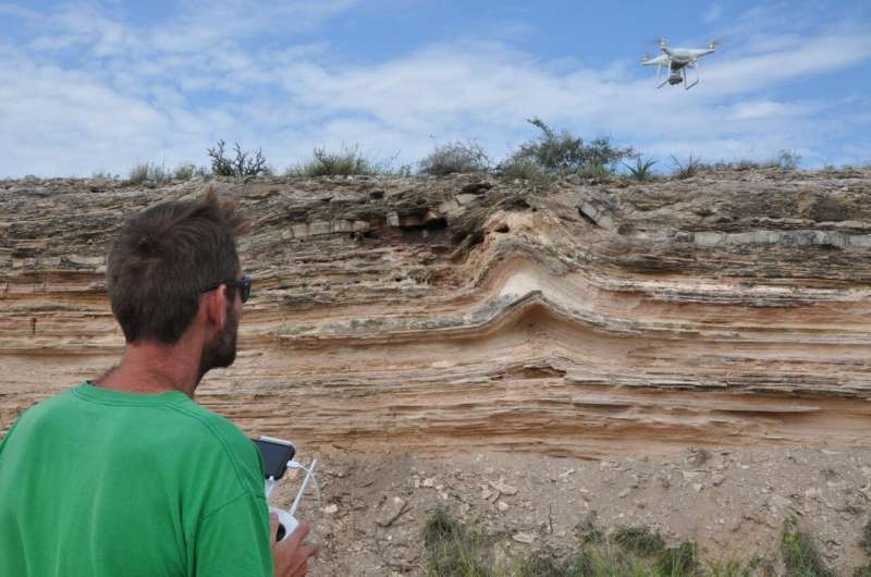
Southwest Research Institute is offering new drone-based, remote-sensing techniques to digitally map and model exposed geologic structures, or outcrops, to better understand subsurface structures associated with petroleum and water reservoirs. Through digital photogrammetry—reconstructing real-world objects in 3-D from overlapping digital images—SwRI can extract accurate and reliable geologic information.
"These new techniques allow us to create 'virtual' outcrops or digital outcrop models (DOMs), a digital 3-D representation of the outcrop surface," said Adam Cawood, who recently joined SwRI after receiving his Ph.D. from the University of Aberdeen (United Kingdom). "We are developing new drone-based, remote-sensing techniques to allow cost-effective 3-D modeling and analysis of the Earth's surface. The information we extract from these models will help us to better understand conditions below ground."
The technique allows computer-based geological interpretation and data extraction where conventional fieldwork may be impractical or unsafe. Drone-based techniques have the potential to substantially increase the amount of geological data that can be collected from field localities.
By using this data-driven approach, SwRI geologists will be able to capture the statistical properties of fault, fracture and fold networks to study geological settings below ground. This will improve understanding of hydrocarbon reservoirs, aquifers and potential sites for geological storage such as carbon dioxide.
"By using modern data collection and analysis techniques, we aim to improve resource management and extraction, and fully unlock the potential of the rocks below our feet," said Cawood, who is presenting research collected via this technique in a digital poster presentation "Scale Dependent Variations in Fracture Network Properties and Implications for Reservoir Characterization: A Fractured Carbonate Analog Study, Northwest Montana" at the American Association of Petroleum Geologists Virtual Annual Meeting (September 29-October 1, 2020).
Using drones for data collection, Cawood then digitally reconstructs outcrops and applies multivariate statistical analysis to predict natural fracture abundance, both at the surface and below ground. These fractures are generally too small to be identified using seismic reflection data but are often critical to fluid storage and flow pathways in hydrocarbon reservoirs and aquifers. By analyzing photogrammetry-based and field-verified data using multivariate statistics to characterize fracture patterns, relationships are developed to predict the presence of fractures where they cannot be directly imaged in seismic data.
This effort uses automated feature detection to improve the efficiency, reliability and speed of digital data collection. Digital data are benchmarked and tested against traditional measurements to ensure that automated extraction provides robust results.
"We see this revolutionary technique as a way to supplement rather than replace traditional field-based data collection and analysis," said Dr. David Ferrill, a SwRI geologist and Institute scientist. "This new approach enhances our already robust capabilities for field-based structural geology and quantitative structural analysis."
Provided by Southwest Research Institute


