Better estimating snowfall depth remotely

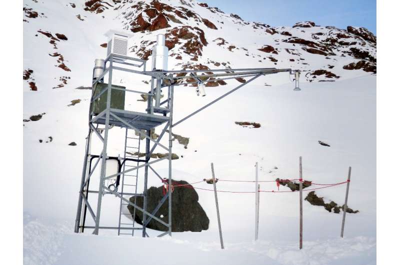
Precipitation that falls on the ground in liquid form can be measured with relatively high accuracy. As soon as it turns to snowfall, however, various difficulties arise. For mountain regions, the amount of snow is an important piece of information. It serves to estimate the danger of avalanches, to plan road clearance or to determine meltwater quantities that have a major influence on hydro-electric power generation. Determining snow quantities involves a variety of measures such as manual measurements by human snow observers or fully automated measuring stations, and each of these comes with different benefits and disadvantages. In areas exposed to strong winds, automated measurements of precipitation and snow depth are sometimes unreliable. Manual measurements are usually performed only once a day. The Austrian Central Institute for Meteorology and Geodynamics (ZAMG) operates automated snow depth measurement stations throughout Austria.
In recent years, these stations have been supplemented by optical snow sensors involving laser technology that can measure the snow depth every ten minutes. Combining the precipitation measurement data with weather radar measurements makes it possible to determine the total amount of precipitation in a given region. Nonetheless, the results tend to be inaccurate, especially in winter. With the help of funding from the Gottfried and Vera Weiss Science Foundation, which is administered by the Austrian Science Fund FWF, the Innsbruck-based hydrologist and meteorologist Kay Helfricht has now analyzed the data from laser measuring stations for snow depth in order to detect and correct errors.
Snow will settle
"We know that the actual amount of precipitation is generally underestimated in the case of snowfall," explains principal investigator Helfricht. "For this reason, correction factors are used on the measured value in standard products for determining the distribution of precipitation." The error occurs, for example, when the snow evaporates on the heated measuring device or drifts away because of wind exposure.
In order to calculate the amount of precipitation on the basis of the height of new snow, one must also know the density of the snow, which is an additional challenge. "The density of fresh snow can vary greatly. The range is predominantly between 50 and 150 kilograms per cubic meter," says Helfricht. Readings supplied by snow observers are used to assess variation in new snow density, but even that does not provide for sufficient accuracy, notes Helfricht: "The daily measurements are not necessarily carried out during snowfall, which means the snow may have settled before the measurement because of heat, its own weight or solar radiation."
Not enough precipitation at measuring stations
How errors in precipitation measurement could be corrected has already been investigated in international studies, but these studies also relied on individual, well-equipped measuring stations. Kay Helfricht went one step further and systematically investigated over 70 ZAMG weather stations equipped with laser measuring devices. He succeeded in calculating the current amount of precipitation from the snow depth data by using the short intervals of one hour or less between the measurements. Subsequently, the meteorologist focused on stations that often yield inaccurate results. Helfricht already became aware of this phenomenon when writing his thesis on the modeling of snow cover in high mountains: "I noted that precipitation measurement tends to work poorly at very exposed stations. There are stations that seem to supply no measurements representative of the surrounding area."
Helfricht explains that the majority of measurements from stations with systematic undercatch can be corrected appropriately. In his project he demonstrated whether and in what way this is possible for each of the investigated stations. This is important for all applications that use weather radar to simulate the amount of new snow. They do it by linking measurements of reflectivity in the air with measurements of precipitation on the ground. If the latter are faulty, the error is transferred to the entire region. Helfricht co-operated closely with ZAMG on this project. The institution is using the results to further improve the quality of precipitation measurements.
More information: Kay Helfricht et al. Obtaining sub-daily new snow density from automated measurements in high mountain regions, Hydrology and Earth System Sciences (2018). DOI: 10.5194/hess-22-2655-2018
Helfricht, K., et al. Investigation performance and correlation of ground-based snow depth and precipitation measurements, arc.lib.montana.edu/snow-scien … s/ISSW2018_P05.6.pdf
Provided by Austrian Science Fund (FWF)


