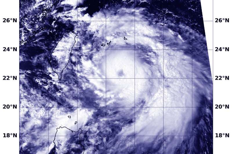
NASA catches the eye of Typhoon Lingling

Typhoon Lingling continues to strengthen in the Northwestern Pacific Ocean and NASA's Terra satellite imagery revealed the eye is now visible.
On Sept. 4 at 1:20 a.m. EDT (0520 UTC) the Moderate Imaging Spectroradiometer or MODIS instrument that flies aboard NASA's Terra satellite showed powerful thunderstorms circling Typhoon Lingling's visible 15 nautical-mile wide eye. The Joint Typhoon Warning Center (JTWC) noted, "Animated enhanced infrared satellite imagery depicts tightly-curved banding wrapping into a ragged eye." In addition, microwave satellite imagery showed a well-defined microwave eye feature.
At 11 a.m. EDT (1500 UTC), the Joint Typhoon Warning Center or JTWC said that Typhoon Lingling, known locally in the Philippines as Liwayway, had moved away from the Philippines enough that warnings have been dropped.
Lingling was located near 23.0 degrees north latitude and 125.4 degrees east longitude. That is 247 nautical miles southwest of Kadena Air Base, Okinawa, Japan. Lingling was moving to the north-northeast and maximum sustained winds had increased to near 80 knots (75 mph/120.3 kph).
JTWC forecasters said that Lingling is moving north and is expected to intensify to 105 knots (121 mph/194 kph) upon passing between Taiwan and Japan.
Provided by NASA's Goddard Space Flight Center


