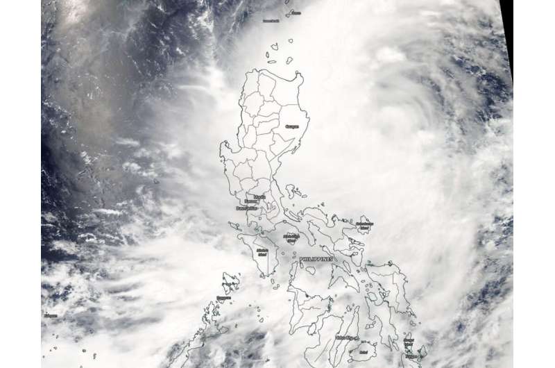
Tropical Depression Danas affecting Philippines in NASA satellite imagery

NASA's Aqua satellite passed over the Northwester Pacific Ocean after the sixth tropical depression formed. Tropical Depression Danas formed northeast of the Northern Philippines and was already affecting the country.
On July 16, the Moderate Resolution Imaging Spectroradiometer or MODIS instrument aboard NASA's Aqua satellite provided a visible image of Danas that showed a large depression the stretched the entire length of the Philippines. Strongest thunderstorms remained off the coast in the image, but the northwestern and western quadrants were already over the Luzon and Visayas regions.
At 5 a.m. EDT (0900 UTC), the center of Danas was located near latitude 17.2 degrees north and longitude 124.9 degrees west. Danas was about 587 nautical miles southwest of Kadena Air Base, Okinawa, Japan. Danas was moving to the west-northwest and had maximum sustained winds near 25 knots (29 mph/46 kph).
The Joint Typhoon Warning Center expects Danas to turn to the north. Danas' center is expected to stay over water until it makes landfall in three days south of Shanghai, China.
Provided by NASA's Goddard Space Flight Center


