Old images give new insight on climate change

When studying climate change, it is often a problem that reliable, comparable data go back just a few decades. Long time series are in high demand, especially when it comes to the Earth's cryosphere, consisting of glaciers, ice and frozen ground.
Old images can be converted into useful geophysical data. Luc Girod has developed methods to make this happen. This enables researchers to better understand the processes in the cryosphere, which is crucial for the ability to predict and project the effects of future climate change.
"People in the geoscience community get very excited when we tell them that we found an old photo archive, processed the information in the images, and then present them with the data," says French photogrammetrist Luc Girod, who recently defended his Ph.D. dissertation at the University of Oslo on remote sensing of the cryosphere.
"You don't always need very good data to say that a glacier is not doing well. But to understand precisely how and why, you need more, better data and to look further back in time."
Since he was a child, Luc Girod has been attracted to travelling, maps and cartography. He studied for an engineering degree at the Institut Géographique National outside Paris. At the end of the first year, he was sent to the south of France to do fieldwork in photogrammetry, which is the science of making measurements from photographs. One year later, in 2012, he opted for somewhere colder when he was asked to find his own place for an international internship.
"I don't like hot weather, so I drew a line on the map north of Denmark. I sent an email to the University of Oslo, and got a positive answer from Andreas Kääb, who – two years later – became my Ph.D. supervisor."
Forced secrets out of stones
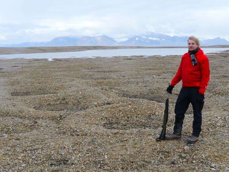
On his first arrival, Luc Girod was asked to study the information in photos of the strange rock circles on Svalbard, known as sorted circles. The photos had been lying around for a few years, waiting for somebody willing to process the information in the images.
Girod took on the task and managed to make sense of the data, revealing some of the secrets of Svalbard's sorted circles. He then returned to France and finished his masters degree.
He specialized in three fields within the geographical sciences; photogrammetry, remote sensing, and geodesy, which is measuring and understanding the exact shape and geometry of the Earth.
Later on, he learned that the Department of Geosciences at the University of Oslo got funding from the European Research Council for a project aiming to improve the way we measure the mass changes of mountain glaciers. The project was established to quantify the connections between changes in mountain glaciers and sea levels. It involved a number of remote sensing technologies and modelling. It turned out to be the perfect theme for Luc Girod's doctoral thesis.

Old satellite still delivers
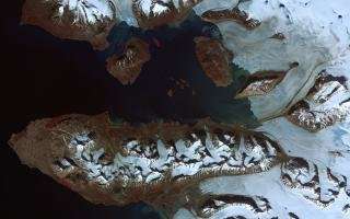
ASTER is an American-Japanese satellite launched by NASA in 1999.
"The technology on a satellite is typically already out of date when they launch it, as it needs to be proven and reliable, so the systems of ASTER were designed in the 1980s. On the other hand, it is still operational and it takes stereo photos. There are two telescopes pointing towards the Earth at different angles, which means we get sets of two slightly different images of the same area. This is important to me, because having two pictures is essential for photogrammetry."
The ASTER images provides the same type of data and images, with consistent quality, going back to 2000. This enables the scientists to observe changes in glaciers during nearly 20 years. The images cover nearly the whole Earth, including all of Svalbard and almost all of Greenland, but data can only be acquiered when there is no cloud cover and sunlight.
Luc Girod has concentrated on studying changes in the elevation on mountain glaciers.
Time series of elevation are hard to come by. Mostly, elevation does not change, so it has rarely been monitored. There are only a few factors that cause large changes in elevation, includings landslides, volcanic eruption and glacier changes.
"One of the reasons that got me interested in the ASTER images was that while NASA had already created elevation models many years ago, their accuracy was only 30 meters. At the time, though, that was quite good – and much better than any other elevation models that existed. I saw a gold mine of information. We just needed better processing methods to harvest it properly. So I got access to the orginal data from ASTER, and built a processing chain from the ground up using new methods," he explains.
Vibrations in the heavy and complicated satellite was one of his challenges, leading to distorted images. Girod thus developed a method to measure the vibrations, and take them into account when processing the images. The result is a series of images with an accuracy of three meters. In other words, ten times better than what existed until now.
"We managed to get some really good information on elevation change. We are now working on ways to use this information in applications. And we hope to publish a paper on elevation change in all of Scandinavia and Svalbard soon. It will be an overall view of a large area during a long time period."
Old aerial photos of Svalbard
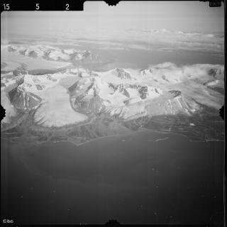
Until the 1930s, there was very little cartography of the Svalbard archipelago. In 1936 and 1938, the Norwegian Polar Institute used airplanes to photograph the islands with their mountains and glaciers. This was a breakthrough for new technology at the time and formed the basis for brand new maps containing information unknown until then.
A few years ago, the Norwegian Polar Institute scanned all the photos from 1936 and 1938, and they can bee viewed at their website. Luc Girod believed it was a good idea to dive into this archive of nearly 4000 photos and check what he could make out of them.

"Most of these pictures are really pretty. They were taken from the side of the airplane, so you get a sideways or oblique view. Normally, in photogrammetry, pictures are taken straight down. With the available technology and methods of the time, it made sense to do it that way. But it made it harder for us to process the images. We had to teach the software to ignore the sky and other irrelevant information. Especially in the beginning, it took a lot of manual handling to filter out data that was not relevant. Then we found a method to automate some of the processing, and we ended up getting more or less full coverage of parts of Svalbard, such as Brøggerhalvøya – where New Ålesund is situated."
Instead of having data on glaciers going back to the 1990s, the geographical community now has data going back to the 1930s.
"Even if the data are not always perfect and details are missing, the overall accuracy is reasonable. And there is so much change from 1936 until today that we are able to tell a story that has not been told before. And we have had reactions from other scientists who regard this as an eye-opener."
Lots of information
Girod's method of processing the information in the old photos can be useful for several other geographical areas. Aerial photos of Greenland and ground photos of the Alps are just two examples.
"There are so many old pictures that have not been processed. It is just a matter of finding them. In some cases, they have even been scanned, but for visualization – not for science, so we need to go back to the originals. There is a lot more work to be done on the Svalbard archive. We have processed less than 200 pictures, so there are thousands more."
Girod envisions that his methods can be useful for other application areas than glaciers, such as documenting how forests and volcanoes have been changing over time.
Old technology and old data
"Developing new technology is of course extremely important. But we must not forget that old technology and old data can also be extremely useful. In many cases, it is not relevant to only study how things have been moving the last two weeks. You need longer perspectives. When you work on climate change, everything is long term!"
"Sometimes, you know that old data exist, but you don't know where to find it. Sometimes, you don't even know that data exist, but may be lucky to stumble over it in the basement of a geographical institute or some private archive. There have been some surprising discoveries over the last few years, so we clearly need methods to utilize the data contained in old photos and other sources."
Modern photogrammetry methods involve automated image processing to transform images to usable information. It is all about geometry.
"I am interested in the shape of things. Knowing the geometry of objects at several points in time is a key factor in everything from glaciology to self driving cars."
Provided by University of Oslo


