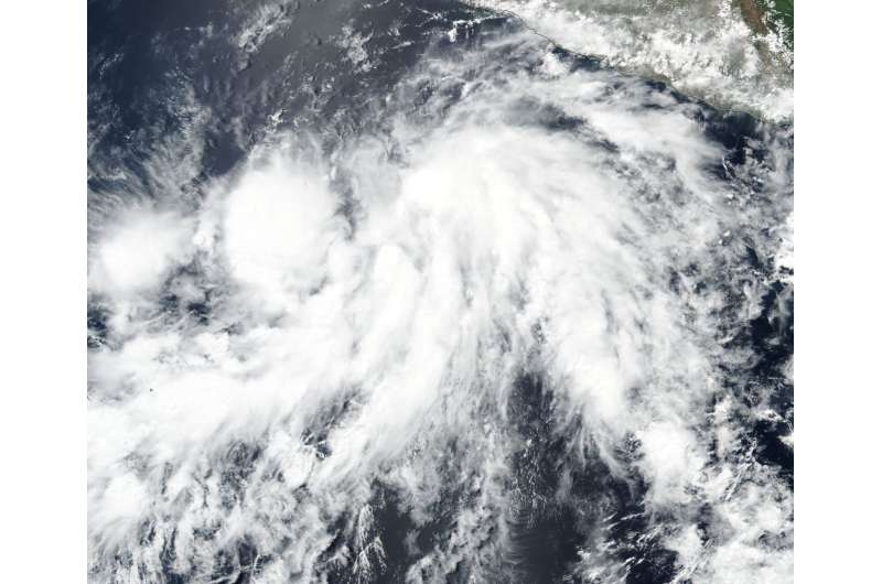
NASA observes the formation of Tropical Storm Aletta

NASA-NOAA's Suomi NPP satellite saw the Eastern Pacific Ocean's first tropical storm coming together.
On June 5, the Visible Infrared Imaging Radiometer Suite (VIIRS) instrument aboard NASA-NOAA's Suomi NPP satellite captured a visible image of Tropical Storm Aletta as it was developing. The VIIRS image showed a better, more organized circulation center with consolidating banding of thunderstorms wrapping into a well-defined low level circulation center. The image was created at NASA's Goddard Space Flight Center in Greenbelt, Md.
By 11 a.m. EDT on June 5, the low pressure area had organized into a tropical depression. Six hours later at 5 a.m. EDT on June 6, tropical depression 1E strengthened into Tropical Storm Aletta, the first of the Eastern Pacific Ocean hurricane season.
The National Hurricane Center noted "At 5 a.m. EDT (0900 UTC), the center of Tropical Storm Aletta was located near latitude 14.1 north, longitude 106.5 west. That's about 370 miles (595 km) south-southwest of Manzanillo, Mexico. The estimated minimum central pressure is 1000 millibars.
Aletta is moving toward the west near 7 mph (11 km/h), but a gradual turn to the west-northwest with no significant change in forward speed is expected during the next 2 to 3 days. Maximum sustained winds have increased to near 45 mph (75 kph) with higher gusts. Aletta is expected to become a hurricane by early Thursday, June 7.
Provided by NASA's Goddard Space Flight Center


