Sentinels modernise Europe's agricultural policy

In a move that could benefit around 22 million farmers, the EU's Common Agricultural Policy has entered the space age. Offering detailed and timely information on crops and farmland, the Copernicus Sentinels are now being used to simplify and modernise this longest-serving EU policy.
The Common Agricultural Policy (CAP) came into force in 1962 to ensure affordable food for European citizens and a fair standard of living for farmers. While this philosophy remains at policy's heart, the focus is also now firmly on sustainability, environmental protection, biodiversity and the climate.
To address these issues, as well as to reduce bureaucracy and increase efficiency, the EU has been taking steps to reform the CAP. Recognising the huge potential of accurate and timely data provided by satellites, the EU turned to space.
Over the last year, through its Sentinels for Common Agriculture Policy (Sen4CAP) project, ESA has been working closely with DG-Agri, DG-Grow and DG-JRC of the EC to demonstrate how the Sentinels could take the policy into a new era.
And following a proposal by DG-Agri, a new CAP monitoring approach came into play on 22 May 2018. This landmark change means that data from the Copernicus Sentinels and other Earth observation missions can replace the physical visits to farms and checks that are necessary for the EU to issue payments to farmers.

Phil Hogan, European Commissioner for Agriculture and Rural Development, said, "This new satellite technology will significantly reduce the number of field inspections, removing the climate of fear, which causes significant stress for farmers.
"It will also benefit public administrations, by reducing the costs of administering controls and checks. It is thus a win-win for farmers and administrators."
Josef Aschbacher, ESA's Director of Earth Observation Programmes, added, "Information from the Sentinels is finding a myriad of uses to improve daily lives, but supporting EU policies was always on top when these state-of-the art missions were conceived.
"I am thrilled that Sentinel-1 and Sentinel-2 missions will now be used to advance the CAP. I have no doubt that their data will make this important policy more efficient and easier to implement, and above all make the life of the farmers easier so that they have more time to focus on farming the food we all rely on."
These two missions offer a wealth of complementary information. For example, the Sentinel-1 radar satellites can deliver data on crop biomass and detect when a crop has been harvested.

Importantly, the satellite pair passes over Europe at least every two days, which means that the latest information is readily available.
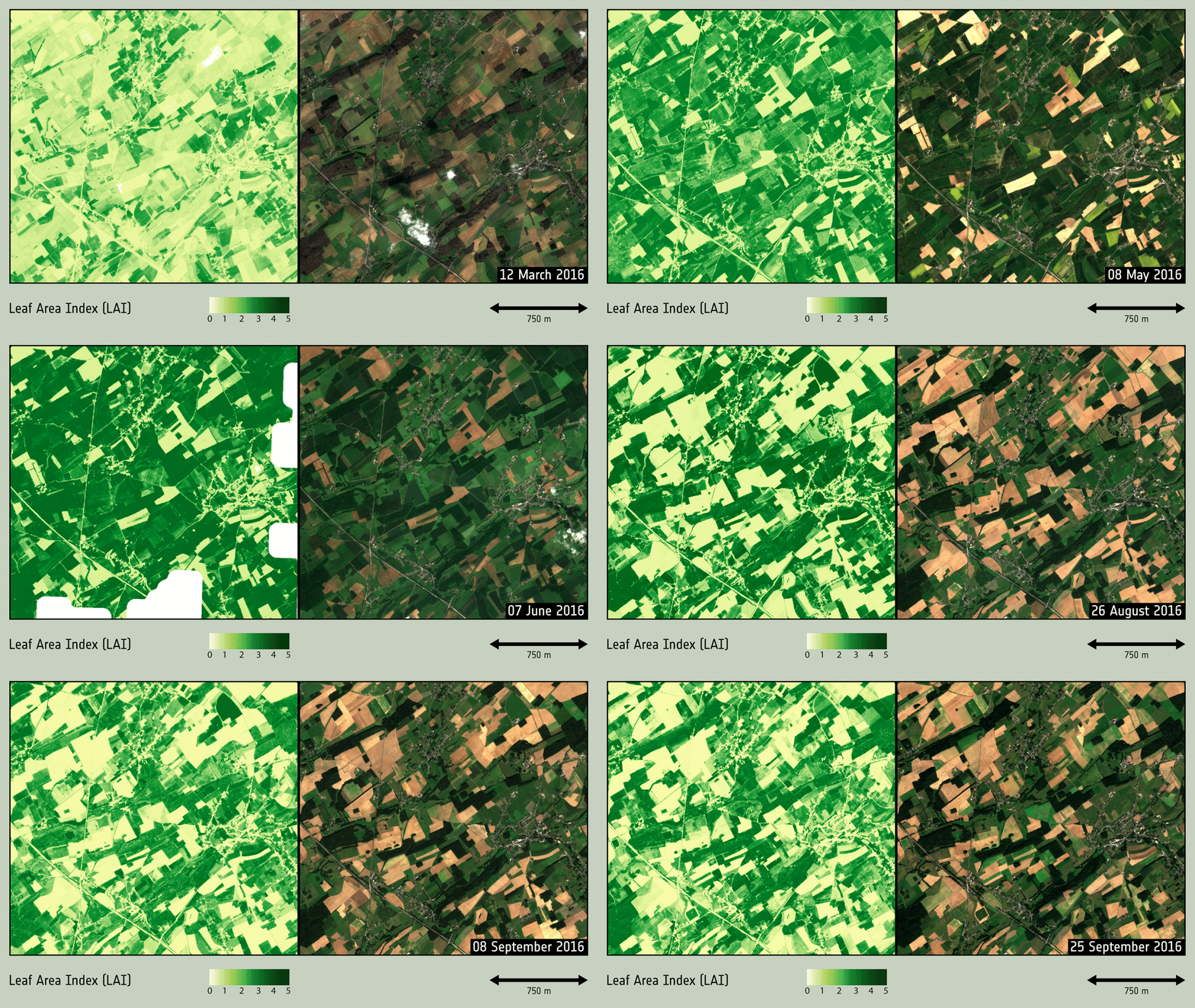
The Sentinel-2 satellites carry high-resolution cameras, images from which can be used to distinguish between different crop types, assess crop health and monitor land-use change. Similar to Sentinel-1, it covers Europe every 3–4 days.
ESA's Benjamin Koetz, who is part of the Sen4CAP team, said, " The operational and systematic observations by the Sentinels have been a breakthrough for agricultural monitoring from space, and now they have enabled the innovative CAP monitoring approach by the EU's DG-Agri.
"Thanks to the Sentinels' frequent revisits and their high-resolution data, farming activities and crop state can be monitored easily. The data can be used, for example, to identify the type of crop planted and how it grows through the season and when it is harvested.
The CAP monitoring approach is also relevant for crop diversification. This is where, in order to be eligible for CAP payments, farmers have to grow a variety of crops, depending on the size of their farm.
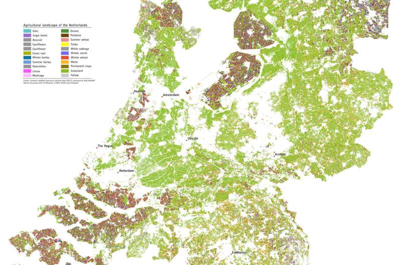
Observations from the Sentinels are analysed with the latest machine-learning algorithms to provide national crop-type maps throughout the season. Already demonstrated over the Netherlands, this information can support farmers in their declarations and it allows them to understand compliancy with the CAP at an early stage.
Provided by European Space Agency


