NASA eyes extremely severe cyclonic mekunu approaching landfall

The Regional Specialized Meteorological Center in New Delhi (RSMC), India noted on May 25 that Mekunu has now been classified as an Extremely Severe Cyclonic Storm. NASA and NOAA satellites provided visible and infrared imagery of the powerful storm as it headed for landfall in Oman. Mekunu was lashing Oman as a Category 3 hurricane.
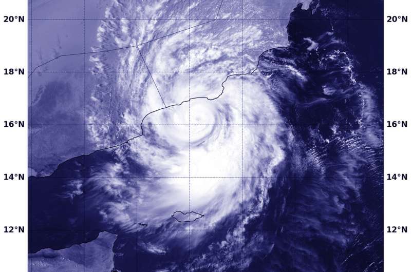
The Moderate Resolution Imaging Spectroradiometer or MODIS instrument aboard NASA's Aqua satellite saw powerful Tropical Cyclone Mekunu in the Arabian Sea on May 25 at 5:45 a.m. EDT (0945 UTC). The Aqua image revealed that Mekunu had developed an eye as it approached landfall in Oman.
Mekunu is now very well defined as compared to its status on May 24. Mekunu has intensified since May 24 according RSMC.
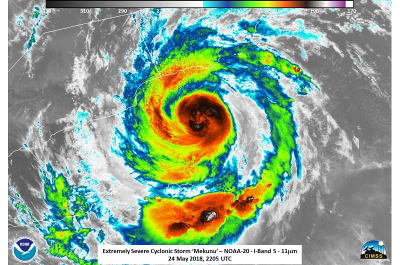
The NOAA-20 satellite captured an infrared image of Mekunu on May 25 that showed temperature data of the cloud tops. Powerful thunderstorms surrounding the low-level center and in a band south of the center had temperatures as cold as or colder than minus 99.6 degrees Fahrenheit (200 kelvin/minus 73.1 degrees Celsius). NASA research has shown that storms with cloud tops that cold shoot high into the troposphere and have the potential to generate heavy rainfall.
At 11 a.m. EDT (1500 UTC) on May 25, the Joint Typhoon Warning Center noted that Mekunu had maximum sustained winds near 115 mph (100 knots/185 kph). That makes it a Category 3 hurricane on the Saffir-Simpson Hurricane Wind Scale. The eye was centered near 16.7 degrees north latitude and 54.2 degrees east longitude. That's approximately 38 nautical miles south-southeast of Salalah, Oman. Mekunu was moving to the north-northwest at 9.2 mph (8 knots/14.8 kph).

In addition, the central pressure was ~964 hectopascals. That makes Mekunu a strong Category 2 storm impacting the Gulf of Aden. The Gulf of Aden is a critical waterway for shipping, especially for oil coming from the Persian Gulf. In 2008, roughly 11 percent of the world's seaborn oil passes through the Gulf of Aden. This does not include all of the cargo ships passing through the region, meaning this is a vital waterway for international trade.
The Joint Typhoon Warning Center noted Mekunu will move north-northwest and will maintain current intensity. The cyclone is forecast to make landfall near Salalah, Oman early on May 26.
Provided by NASA's Goddard Space Flight Center


