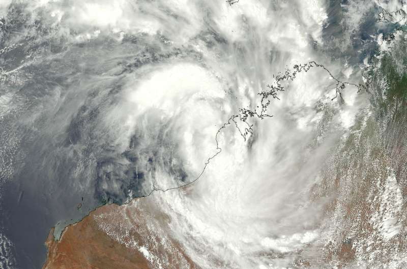
Tropical Cyclone Joyce soaking northwestern Australia coast

Tropical Cyclone Joyce, formerly known as tropical cyclone 5S, was moving south along the coast of Cape Leveque, Western Australia on Jan. 11 when a polar-orbiting satellite passed overhead. NOAA's JPSS-1 satellite provided a visible image of the tropical storm as it continued to move south along the northwestern part of Western Australia.
On Jan. 11 at 12:54 a.m. EST (0554 UTC) NOAA's JPSS-1 or NOAA-20 satellite showed Joyce's center just off the coast, while bands of thunderstorms wrapping into the center extended toward the northwest over the Southern Indian Ocean, and toward the southeast over Western Australia.
NOAA-20, designated JPSS-1 prior to launch, is the first of NOAA's latest generation of U.S. polar-orbiting, non-geosynchronous, environmental satellites called the Joint Polar Satellite System. NOAA-20 was launched on November 18, 2017 and joined the Suomi National Polar-orbiting Partnership satellite in the same orbit.
At 10 a.m. EST (1500 UTC) on Jan. 11, Tropical Cyclone Joyce had maximum sustained winds near 45 knots (51.7 mph/83.3 kph). It was centered near 18.0 degrees south latitude and 121.5 degrees east longitude. That's about 40 nautical miles west of Broome, Australia. It was moving to the south at 7 knots (8 mph/12.9 kph).
Because Tropical Joyce was hugging the coast, the Australian Bureau of Meteorology (ABM) posted warnings and watches again today, Jan. 11. A tropical cyclone watch is in force from Beagle Bay to Port Hedland, including Broome and Port Hedland, as well as remaining inland parts of the far western Kimberley and far northeast Pilbara. A tropical cyclone watch is in force from Port Hedland to Dampier, including Karratha and Dampier, as well as remaining inland parts of the central and eastern Pilbara, including Nullagine, Marble Bar, Telfer, Newman and Tom Price
ABM forecasts Joyce will make landfall near Wallal Downs mid-day, local time on Jan. 12 and move southwest, staying just west of Marble Bar and Nullagine. Joyce is expected to weaken to a low pressure area and move between the towns of Tom Price and Newman on its southwestern track.
Provided by NASA's Goddard Space Flight Center


