Mapping migrant communities across Europe to support local integration

This week scientists unveiled a unique dataset that maps the diverse migrant communities living in the EU.
The maps will provide policy makers with new insights and a better overall picture to develop local policies to help migrants integrate in their host countries.
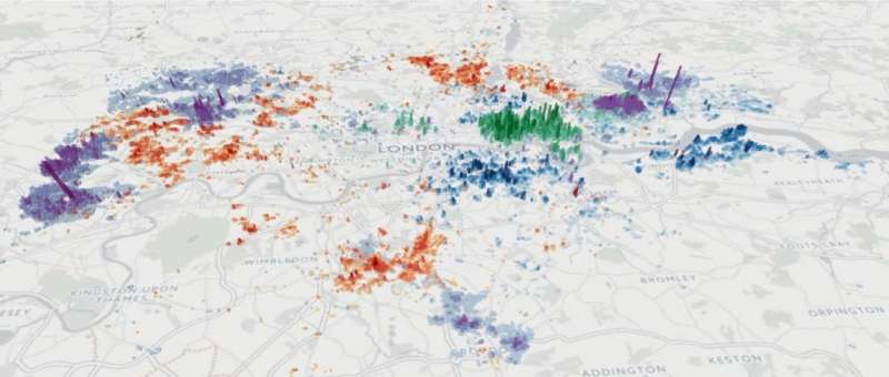
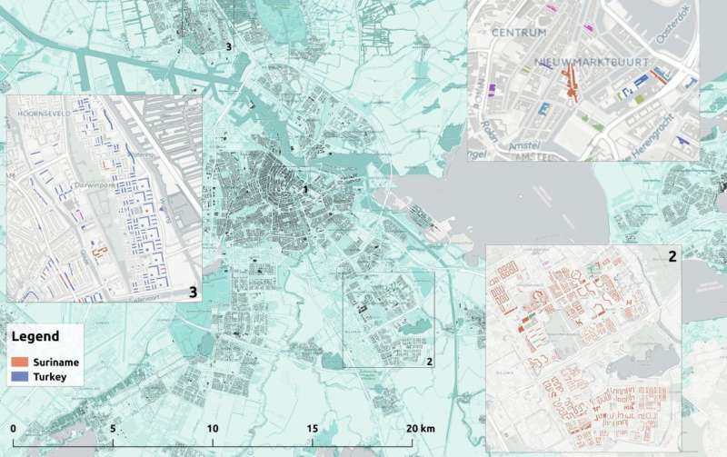
The maps show residential patterns of migrant communities by their nationality or the country where they were born, at the level of neighbourhoods. From the underlying data researchers can calculate the concentration, diversity and segregation of migrants from different countries and compare these indicators within and across cities.
For example, JRC scientists found that Chinese and Filipino communities in Europe are likely to be highly clustered and segregated from their host communities.
Scientists also found that there is a general correlation between how segregated a migrant community may be and the geographical and linguistic distance between their countries of origin and destination.
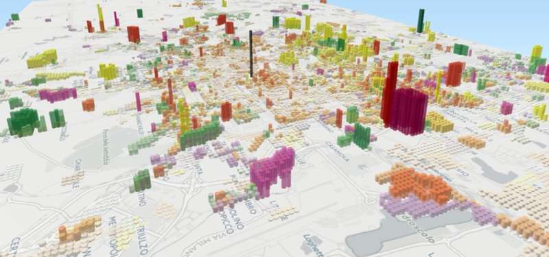
Data has been spatially processed to produce high resolution maps like this one of Milan. Here, the map shows levels of concentration of migrants from the Philippines (orange), China (yellow), Egypt (green), and Peru (red) across residential areas.
Levels of segregation may correlate with cultural and geographical distance

In order to highlight the potential of the data and inspire potential applicants, JRC scientists presented some preliminary analysis of the dataset at the European Week of Regions and Cities.
For example, large migrant communities tend to be more spatially dispersed, yet have lower exposure to their host community. Segregation may also be linked to a community's history of migration, or to intrinsic socio-cultural and economic characteristics affecting the tendency of the community to maintain cohesive groups.
With further investigation, these kinds of observations can help authorities to design targeted policies.
For example, knowing where migrants live could help ensure that language training - to help migrants find work, socialise and carry out general tasks like opening a bank account - is held in a venue that is easily accessible.
Knowing the origin countries of migrants across neighbourhoods also helps authorities communicate integration services that are adapted to the cultural background of the communities in the vicinity.
JRC launches data challenge to harness the power of research for better policymaking
The data has the potential to inform a wide range of policy areas, including social services, education, housing and employment.

In order to maximise this potential and foster innovative policy ideas, the JRC has launched a data challenge inviting researchers worldwide to propose research projects connecting the dataset with their area of expertise.
The deadline for submission of proposals is Monday 30 October. An event is planned for the second half of 2018 in Brussels to present the results of the best papers to EU policy makers and local authorities.
Background
The datasets and resulting maps have been produced in the context of the JRC's Knowledge Centre on Migration and Demography (KCMD). The KCMD works towards better knowledge management for sound EU policy making. To strengthen the Commission's overall response to the opportunities and challenges related to migration, the KCMD aims to be the point of reference to support the work of Commission services and Member States on migration and related issues.
The project is designed to support the European Commission's action plan on the integration of third-country nationals and the urban agenda for the EU. Specifically, it supports the Commission's aim to facilitate evidence based migrant integration policies.
The maps cover 8 countries and 45,000 local administrative units, with a detail down to street level. JRC scientists generated the maps by harmonising and spatially processing official census statistics collected from national institutes in France, Germany, Ireland, Italy, the Netherlands, Portugal, Spain and the UK.
Provided by European Commission Joint Research Centre


