Satellites show Hurricane Katia crawling to the Mexico coast

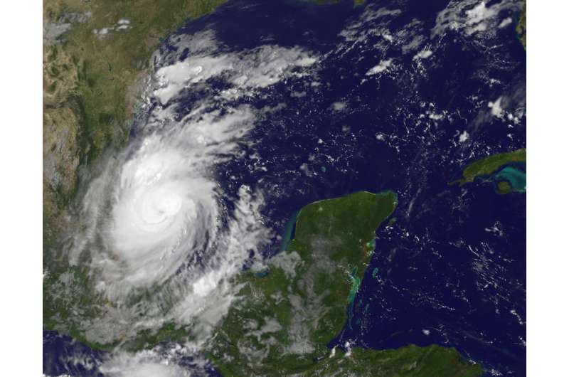
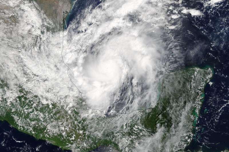
Two days of satellite imagery from NASA's Terra and NOAA's GOES East satellites showed that Hurricane Katia was starting to crawl to the coast of southeastern Mexico.
On Sept. 7 at 1 p.m. EDT (1700 UTC) the Moderate Resolution Imaging Spectroradiometer or MODIS instrument aboard NASA's Terra satellite captured a visible-light image of Hurricane Katia in the southwestern Gulf of Mexico. The image showed powerful bands of thunderstorms around the center of circulation but the storm's eye was not visible. The western quadrant of the storm was over the east coast state of Veracruz, Mexico.
There is the indication of an eye in a visible light image from NOAA's GOES East satellite on Sept. 8 at 9:15 a.m. EDT (1315 UTC).
The National Hurricane Center noted that a NASA Global Precipitation Measurement mission (GPM) satellite microwave composite image indicated improved banding over the western portion of the circulation and the earlier ragged eye presentation has become much more distinct. Katia is also starting to move toward the southwest.
On Sept. 8, the National Hurricane Center (NHC) said a Hurricane Warning is in effect for Cabo Rojo to Laguna Verde, and a Tropical Storm Warning is in effect from north of Cabo Rojo to Rio Panuco and south of Laguna Verde to Puerto Veracruz.

Storm Surge, Hurricane Winds and Heavy Rainfall
NHC noted that dangerous storm surge will raise water levels by as much as 5 to 7 feet above normal tide levels near and to the north of where Katia makes landfall. Near the coast, the surge will be accompanied by large and destructive waves.
Katia is expected to produce total rain accumulations of 10 to 15 inches over northern Veracruz, eastern Hidalgo, and Puebla. Katia is also expected to produce total rain accumulations of 2 to 5 inches over southern Tamaulipas, eastern San Luis Potosi, western Hidalgo, eastern Queretaro, and southern Veracruz through Saturday evening. Isolated maximum amounts of 25 inches are possible in northern Veracruz, eastern Hidalgo, Puebla, and San Luis Potosi. This rainfall may cause life-threatening flash floods and mudslides, especially in areas of mountainous terrain.
Katia's Location
At 7 a.m. CDT (8 a.m. EDT/1200 UTC) on Sept. 8 the center of Hurricane Katia was located near 21.1 degrees north latitude and 95.6 degrees west longitude. That's 140 miles (220 km) north-northeast of Veracruz, Mexico.
Katia is moving toward the west-southwest near 3 mph (6 km/h) and this general motion is expected to continue until the system makes landfall within the hurricane warning area by early Saturday, Sept. 9.
Maximum sustained winds are near 90 mph (150 kph) with higher gusts. Some additional strengthening is forecast during the next day or so and Katia could be near major hurricane strength at landfall. Hurricane-force winds extend outward up to 10 miles (20 km) from the center and tropical-storm-force winds extend outward up to 60 miles (95 km). The estimated minimum central pressure is 977 millibars.
The National Hurricane Center forecasts Katia to make landfall on Saturday, Sept. 9.
Provided by NASA's Goddard Space Flight Center


